Trek Zone

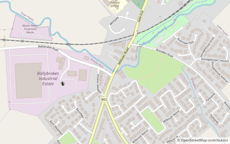
Milltown Road, Ballymoney

#2 among attractions in Ballymoney

Bridge
Milltown Road

Facts and practical information

Milltown Road (address: 2-4 Milltown Road) is a place located in Ballymoney (Northern Ireland province) and belongs to the category of bridge.

It is situated at an altitude of 102 feet, and its geographical coordinates are 55°3'48"N latitude and 6°31'12"W longitude.

Among other places and attractions worth visiting in the area are: Riada Stadium (sport, 22 min walk), Slieveanorra Forest (national park, 39 min walk), Craigs Dolmen (archaeological site, 130 min walk).

Coordinates: 55°3'48"N, 6°31'12"W
Address

2-4 Milltown RoadBallymoney United Kingdom

ContactAdd
Social media
Add

Ballymoney plan & book

Unleash the traveler in you — discover the cheapest flight deals, find the perfect hotel or hostel nearby, and search for the best car rental prices. Travel at your own pace to discover new places and enjoy your journey.

Day trips

Milltown Road – popular in the area (distance from the attraction)

Nearby attractions include: The Dark Hedges, Craigs Dolmen, Slieveanorra Forest, Moneydig Presbyterian Church.

  • the dark hedges ballymoney7.4 miNE
  • craigs dolmen5.1 miS
  • slieveanorra forest1.5 miS
  • moneydig presbyterian church location map
    5.9 miSW
  • the showgrounds coleraine7.3 miNW
  • lodge road coleraine location map
    6.8 miNW
  • riada stadium location map
    0.9 miE

Where to next? Visit northern ireland Northern Ireland region page or discover the top tourist attractions in United Kingdom.