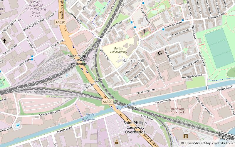
Barton Hill, Bristol
Map
Facts and practical information
Barton Hill is an area of Bristol, just to the east of the city centre and Bristol Temple Meads railway station. ()
Coordinates: 51°27'9"N, 2°33'58"W
Address
Lawrence HillBristol
ContactAdd
Social media
Add
Getting there by public transportation
Public transportation stops near this location
- Bus
- Train
 Bus
Bus
- Calculate routeLawrence Hl Stn c 10 min walk
- Calculate routeLawrence Hill Station 10 min walk
- Calculate routeLawrence Hl Stn b 10 min walk
- Calculate routeCroydon Street 11 min walk
- Calculate routeLawrence Hill 11 min walk
- Calculate routeBristol Temple Meads 17 min walk
- Calculate routeStapleton Road 27 min walk
- Calculate routeMontpelier 38 min walk
Day trips


Frequently Asked Questions (FAQ)
Which popular attractions are close to Barton Hill?
Nearby attractions include Bristol Feeder Canal, Bristol (4 min walk), Avon Bridge, Bristol (11 min walk), St Philip's Marsh, Bristol (11 min walk), Netham Lock, Bristol (13 min walk).
How to get to Barton Hill by public transport?
The nearest stations to Barton Hill:
Bus
Train
Bus
- Lawrence Hl Stn c • Lines: 43, 635 (10 min walk)
- Lawrence Hill Station • Lines: 635 (10 min walk)
Train
- Lawrence Hill (11 min walk)
- Bristol Temple Meads (17 min walk)