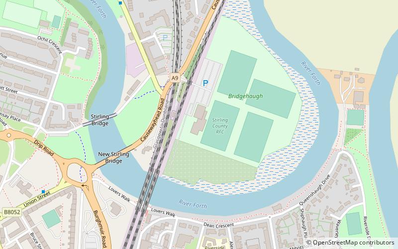
Bridgehaugh Park, Stirling
Map
Facts and practical information
Bridgehaugh Park is a rugby union ground in Stirling, Scotland, with a capacity of approximately 4,000. ()
Capacity: 4000Coordinates: 56°7'43"N, 3°55'57"W
Address
Stirling
ContactAdd
Social media
Add
Getting there by public transportation
Public transportation stops near this location
- Bus
- Train
 Bus
Bus
- Calculate routeStirling 16 min walk
- Calculate routeStirling Bus Station 19 min walk
- Calculate routeAllan Park South Church 21 min walk
Day trips


Frequently Asked Questions (FAQ)
Which popular attractions are close to Bridgehaugh Park?
Nearby attractions include Old Bridge, Stirling (5 min walk), Mote Hill, Stirling (11 min walk), Statue of Robert the Bruce, Stirling (17 min walk), Forthside Bridge, Stirling (17 min walk).
How to get to Bridgehaugh Park by public transport?
The nearest stations to Bridgehaugh Park:
Train
Bus
Train
- Stirling (16 min walk)
Bus
- Stirling Bus Station • Lines: 24, B12, C11, X39 (19 min walk)
- Allan Park South Church • Lines: B12 (21 min walk)