Earlswood Lakes, Solihull
Map

Gallery

Facts and practical information
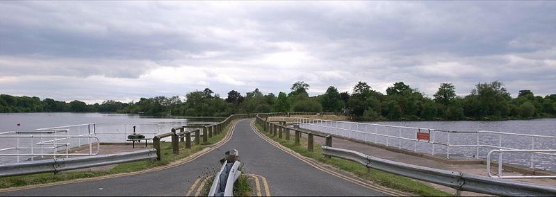
Earlswood Lakes is the modern name for three man-made reservoirs which were built in the 1820s at Earlswood in Warwickshire, England, to supply water to the Stratford-upon-Avon Canal. They still supply the canal, and also provide leisure facilities, including sailing, fishing and walking. The northern banks of the lakes form the borough and county boundary with the Metropolitan Borough of Solihull and the West Midlands. ()
Coordinates: 52°21'47"N, 1°50'24"W
Address
Solihull
ContactAdd
Social media
Add
Day trips
Earlswood Lakes – popular in the area (distance from the attraction)
Nearby attractions include: Packwood House, Touchwood, Wythall miniature railway, St James the Great.
Frequently Asked Questions (FAQ)
How to get to Earlswood Lakes by public transport?
The nearest stations to Earlswood Lakes:
Train
Train
- The Lakes (9 min walk)
- Earlswood (24 min walk)


