Park Road Stadium, Stockport

Gallery (1)
Map
Map
Facts and practical information
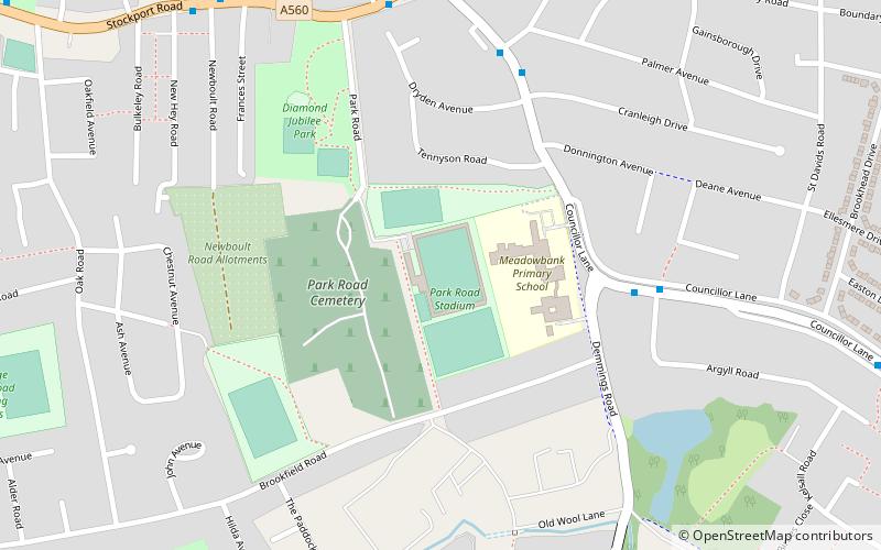
Park Road Stadium is an association football stadium in Cheadle, Greater Manchester, England. It is the home ground of North West Counties Football League club Cheadle Town F.C. It has a capacity of 2,000 people, with 100 seated. ()
Coordinates: 53°23'32"N, 2°12'13"W
Address
Stockport (Cheadle)Stockport
ContactAdd
Social media
Add
Getting there by public transportation
Public transportation stops near this location
- Bus
- Train
 Bus
Bus
- Calculate routeCheadle, Councillor Lane / near Demmings Road 4 min walk
- Calculate routeCheadle, Stockport Road / near Councillor Lane 6 min walk
- Calculate routeCheadle, Stockport Road / outside Red Lion 8 min walk
- Calculate routeGatley 29 min walk
- Calculate routeCheadle Hulme 33 min walk
Day trips


Frequently Asked Questions (FAQ)
Which popular attractions are close to Park Road Stadium?
Nearby attractions include Cheadle, Stockport (11 min walk), Abney Hall, Stockport (15 min walk), St Mary's Church, Stockport (16 min walk), Cheadle and Marple Sixth Form College, Stockport (20 min walk).
How to get to Park Road Stadium by public transport?
The nearest stations to Park Road Stadium:
Bus
Train
Bus
- Cheadle, Councillor Lane / near Demmings Road • Lines: 328 (4 min walk)
- Cheadle, Stockport Road / near Councillor Lane • Lines: 11, 11A (6 min walk)
Train
- Gatley (29 min walk)
- Cheadle Hulme (33 min walk)