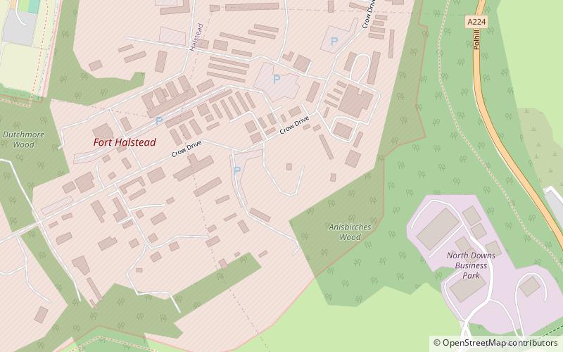
Fort Halstead, Sevenoaks
Map
Facts and practical information
Fort Halstead is a research site of Dstl, an executive agency of the UK Ministry of Defence. It is situated on the crest of the Kentish North Downs, overlooking the town of Sevenoaks, southeast of London. Originally constructed in 1892 as part of a ring of fortresses around London, Fort Halstead was to be staffed by volunteers in the event of a crisis. ()
Coordinates: 51°18'42"N, 0°8'58"E
Getting there by public transportation
Public transportation stops near this location
- Bus
- Train
 Bus
Bus
- Calculate routeStar Hill Road 15 min walk
- Calculate routePolhill Arms 21 min walk
- Calculate routeHampton Cottages 22 min walk
- Calculate routeRose and Crown 24 min walk
- Calculate routeDunton Green 36 min walk
Day trips


Frequently Asked Questions (FAQ)
How to get to Fort Halstead by public transport?
The nearest stations to Fort Halstead:
Bus
Train
Bus
- Star Hill Road • Lines: 3, S31, S32, S33 (15 min walk)
- Polhill Arms • Lines: S34 (21 min walk)
Train
- Dunton Green (36 min walk)