Old Bedians, Manchester
Map
Facts and practical information
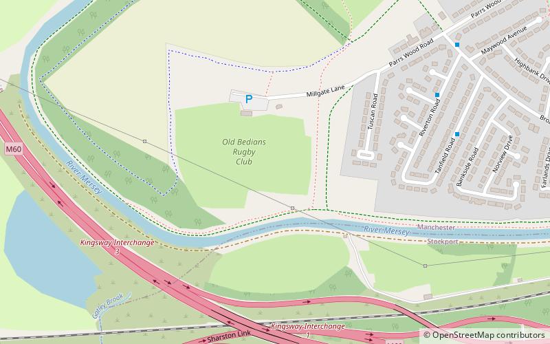
Old Bedians Sports Centre is a mixed use sports centre located in East Didsbury, being home to Didsbury Old Bedians RUFC rugby club, Bedians AFC football club and Oisins CLG Gaelic Football club. Old Bedians is located south of Manchester, on the north bank of the River Mersey. It is the principal Gaelic games sports facility in Lancashire and is currently the home grounds of Lancashire GAA and CLG Oisín. ()
Coordinates: 53°24'7"N, 2°14'13"W
Address
Didsbury EastManchester
ContactAdd
Social media
Add
Getting there by public transportation
Public transportation stops near this location
- Bus
- Tram
- Train
 Bus
Bus
- Calculate routeEast Didsbury, northbound Riverton Road 6 min walk
- Calculate routeGatley 17 min walk
- Calculate routeEast Didsbury 21 min walk
- Calculate routeEast Didsbury 28 min walk
- Calculate routeDidsbury Village 28 min walk
- Calculate routeBenchill 33 min walk
Maps MetrolinkMaps
 Metrolink / Rail
MetrolinkMapsMetrolink / RailDay trips


Frequently Asked Questions (FAQ)
Which popular attractions are close to Old Bedians?
Nearby attractions include Fletcher Moss Botanical Garden, Manchester (15 min walk), Church of St James, Manchester (16 min walk), Ladybrook Valley, Stockport (16 min walk), Barnes Hospital, Stockport (17 min walk).
How to get to Old Bedians by public transport?
The nearest stations to Old Bedians:
Bus
Train
Tram
Bus
- East Didsbury, northbound Riverton Road • Lines: 171 (6 min walk)
Train
- Gatley (17 min walk)
- East Didsbury (21 min walk)
Tram
- East Didsbury • Lines: EDid, Roch, Shaw (28 min walk)
- Didsbury Village • Lines: EDid, Roch, Shaw (28 min walk)