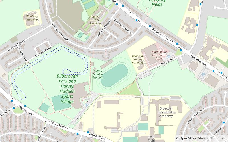
Harvey Hadden Stadium, Nottingham
Map
Facts and practical information
The Harvey Hadden Stadium is a purpose-built athletics stadium in the Bilborough district of Nottingham, England which is the home of the Nottingham Caesars, an American Football team playing in the BAFA National Leagues as well as the Nottinghamshire Athletics Club and both the Athletic clubs of Nottingham Trent University and the University of Nottingham. ()
Capacity: 1600Coordinates: 52°58'5"N, 1°12'59"W
Address
BilboroughNottingham
ContactAdd
Social media
Add
Getting there by public transportation
Public transportation stops near this location
- Bus
 Bus
Bus
- Calculate routeDenewood Crescent 5 min walk
- Calculate routeHighwood Avenue 6 min walk
- Calculate routeGraylands Road 6 min walk
- Calculate routeFircroft Avenue 8 min walk
Day trips


Frequently Asked Questions (FAQ)
Which popular attractions are close to Harvey Hadden Stadium?
Nearby attractions include Broxtowe Estate, Nottingham (22 min walk), St Margaret's Church, Nottingham (23 min walk).
How to get to Harvey Hadden Stadium by public transport?
The nearest stations to Harvey Hadden Stadium:
Bus
Bus
- Denewood Crescent • Lines: L4 (5 min walk)
- Highwood Avenue • Lines: L4 (6 min walk)