Broxtowe Estate, Nottingham

Gallery (1)
Map
Map
Facts and practical information
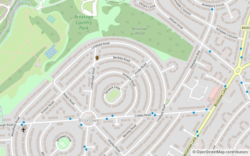
Broxtowe is a council estate in the City of Nottingham which is part of the Aspley ward. The estate is located 3 miles from the City Centre and lies west of Aspley and Cinderhill, south of Bulwell, east of Strelley and north of Bilborough. At the 2001 census, the estate had a population of 4,847. ()
Coordinates: 52°58'48"N, 1°12'53"W
Address
AspleyNottingham
ContactAdd
Social media
Add
Getting there by public transportation
Public transportation stops near this location
- Bus
- Tram
 Bus
Bus
- Calculate routeColeby Road Top 4 min walk
- Calculate routeBeckley Road 4 min walk
- Calculate routeDenton Green 5 min walk
- Calculate routeColeby Road Bottom 6 min walk
- Calculate routePhoenix Park 18 min walk
- Calculate routeCinderhill 22 min walk
- Calculate routeHighbury Vale B 31 min walk
Day trips


Frequently Asked Questions (FAQ)
Which popular attractions are close to Broxtowe Estate?
Nearby attractions include Cinderhill, Nottingham (14 min walk), Christ Church, Nottingham (20 min walk).
How to get to Broxtowe Estate by public transport?
The nearest stations to Broxtowe Estate:
Bus
Tram
Bus
- Coleby Road Top • Lines: 35 (4 min walk)
- Beckley Road • Lines: 35 (4 min walk)
Tram
- Phoenix Park • Lines: 2 (18 min walk)
- Cinderhill • Lines: 2 (22 min walk)