Mudeford Wood Community Centre, Christchurch

Gallery (1)
Map
Map
Facts and practical information
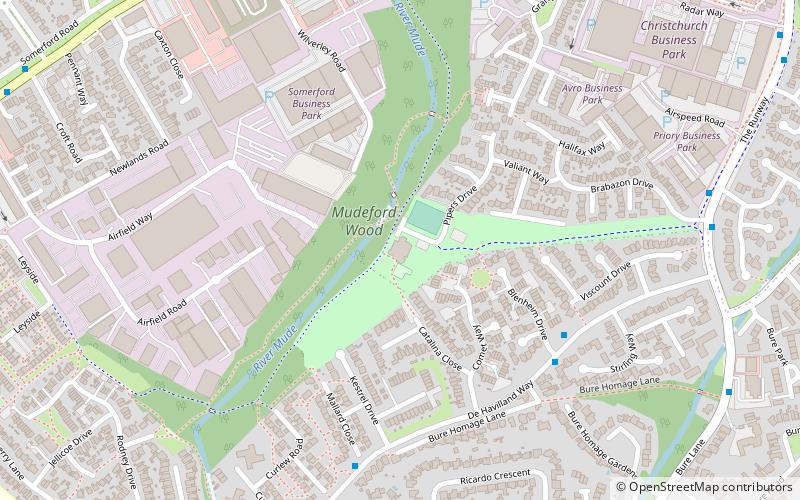
Mudeford Wood Community Centre (address: Pipers Drive, Mudeford) is a place located in Christchurch (England kingdom) and belongs to the category of sightseeing.
It is situated at an altitude of 23 feet, and its geographical coordinates are 50°44'12"N latitude and 1°44'28"W longitude.
Planning a visit to this place, one can easily and conveniently get there by public transportation. Mudeford Wood Community Centre is a short distance from the following public transport stations: Blenheim Drive (bus, 5 min walk).
Among other places and attractions worth visiting in the area are: Mudeford (area, 16 min walk), Christchurch Harbour (neighbourhood, 29 min walk), Highcliffe Castle (architecture, 31 min walk).
Coordinates: 50°44'12"N, 1°44'28"W
Getting there by public transportation
Public transportation stops near this location
- Bus
 Bus
Bus
- Calculate routeBlenheim Drive 5 min walk
- Calculate routeGrebe Close 7 min walk
Day trips


Frequently Asked Questions (FAQ)
How to get to Mudeford Wood Community Centre by public transport?
The nearest stations to Mudeford Wood Community Centre:
Bus
Bus
- Blenheim Drive • Lines: 11, X1, X2 (5 min walk)
- Grebe Close • Lines: 11, X1, X2 (7 min walk)