Scoat Fell
#1513 among destinations in the United Kingdom
![Scoat Fell location map](https://tzmedia.b-cdn.net/media/images/static-maps/gb/54_4936_-3_29247.jpg)
Facts and practical information
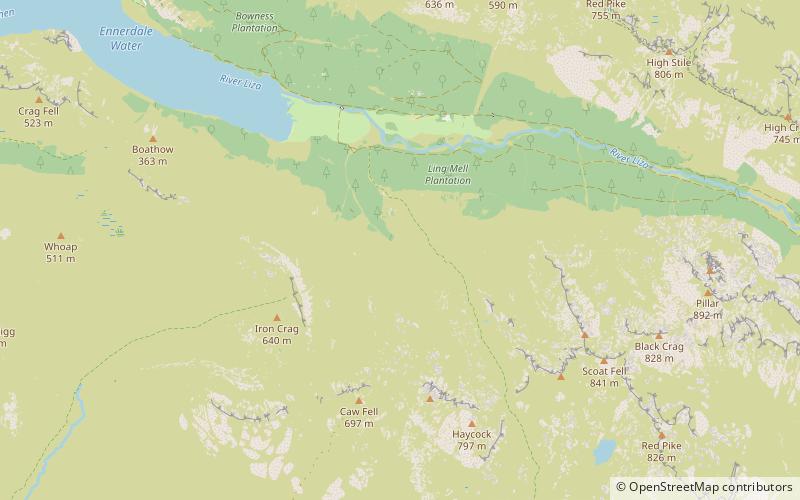
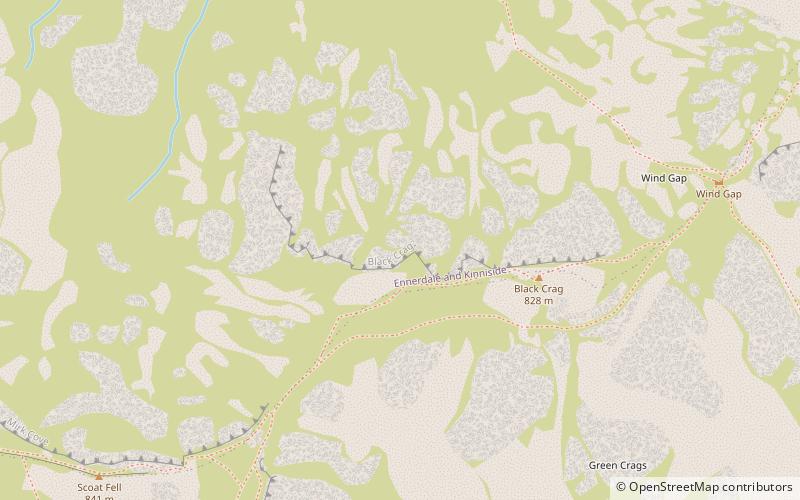
Scoat Fell is a fell in the western part of the English Lake District. It stands at the head of the Mosedale Horseshoe with its back to Ennerdale. Paths lead to Scoat Fell from Ennerdale over Steeple, from Wasdale over Red Pike, and along the ridge from Pillar. ()
EnglandUnited Kingdom
Scoat Fell plan & book
Unleash the traveler in you — discover the cheapest flight deals, find the perfect hotel or hostel nearby, and search for the best car rental prices. Travel at your own pace to discover new places and enjoy your journey.
Scoat Fell – popular in the area (distance from the attraction)
Nearby attractions include: Buttermere, Innominate Tarn, Church of St Olaf, Blackbeck Tarn.
2.8 miNENature, Natural attraction, LakeButtermere
72 min walk • Nestled in the serene landscape of the Lake District National Park, Buttermere stands as a picturesque emblem of natural beauty in the United Kingdom. This tranquil lake, flanked by the dramatic crests of the surrounding fells, presents an idyllic setting that has...
2.2 miENature, Natural attraction, LakeInnominate Tarn, Lake District National Park
57 min walk • Innominate Tarn is a small tarn in the north of the Lake District National Park in England. It is situated at 520 metres above sea level, near the summit of Haystacks. The name Innominate means "without a name". It was formerly known as Loaf Tarn. The tarn is the location where Alfred Wainwright's ashes were scattered.
2.4 miSEChurch, Historical placeChurch of St Olaf, Lake District National Park
62 min walk • St Olaf's Church in Wasdale Head, Cumbria, is England's smallest parish church. The earliest record of the church is from 1550, though it probably predates this, and it is likely that there was an earlier church on this site.
2.5 miENature, Natural attraction, LakeBlackbeck Tarn, Lake District National Park
63 min walk • Blackbeck Tarn is a small tarn in Cumbria, England, situated near the summit of Haystacks in the Buttermere Valley. At an elevation of 486 m, the lake has an area of 0.95 hectares and measures 183 m × 80 m, with a maximum depth of 2.5 m.
2.1 miNEHillHaystacks, Lake District National Park
53 min walk • Haystacks, or Hay Stacks, is a hill in England's Lake District, situated at the south-eastern end of the Buttermere Valley. Although not of any great elevation, Haystacks has become one of the most popular fells in the area.
2.3 miNNature, Natural attraction, LakeBleaberry Tarn
60 min walk • Bleaberry Tarn is a small natural mountain tarn near Buttermere in the English Lake District. Located at NY165154, it lies in a corrie below the Lakeland fells of Red Pike and High Stile, backed by Chapel Crags on the ridge between them.
1.5 miWNature, Natural attraction, CliffHaycock
39 min walk • Haycock is a mountain in the western part of the English Lake District. It rises between Scoat Fell and Caw Fell to the south of Ennerdale and the north of Wasdale.
1.8 miWProtected areaPillar and Ennerdale Fells, Lake District National Park
45 min walk • Pillar and Ennerdale Fells is a Site of Special Scientific Interest in Ennerdale, Cumbria, England. Protected for its biological interest, the site is named after Pillar, which at 892 metres is the eighth-highest mountain in the Lake District, and other fells in the same range.
2 miWHillCaw Fell, Lake District National Park
52 min walk • Caw Fell is a fell in the English Lake District, standing between Haycock the Lank Rigg group. It occupies a wide upland area with Ennerdale to the north and Blengdale to the south.
2.5 miSWHillSeatallan, Eskdale Green
65 min walk • Seatallan is a mountain in the western part of the English Lake District. It is rounded, grassy and fairly unassuming, occupying a large amount of land.
2.3 miNNature, Natural attraction, HillRed Pike
60 min walk • Red Pike is a fell in the High Stile range in the western English Lake District, which separates Ennerdale from the valley of Buttermere and Crummock Water. It is 2,476 ft high.