Traeth Mawr, Tremadog
#5 among attractions in Tremadog
![blank map](https://tzassets.b-cdn.net/static/img/blank-map-colors-sm.png)
![Traeth Mawr, Tremadog](https://tzmedia.b-cdn.net/media/images/gb/place/gallery/medium/0b7031c1c73c7350f50d4b2a8e5b9e0f.jpg)
Facts and practical information
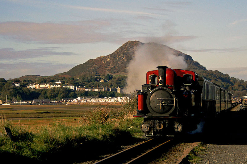
Traeth Mawr is a polder near Porthmadog in Gwynedd in Wales. The area was formerly the large tidal estuary of the Afon Glaslyn. It was created after large-scale land reclamation occurred in the late 18th century and the early 19th century. A large embankment, called the Cob, separates the area from the sea and carries a road and railway line. ()
Tremadog United Kingdom
Tremadog plan & book
Unleash the traveler in you — discover the cheapest flight deals, find the perfect hotel or hostel nearby, and search for the best car rental prices. Travel at your own pace to discover new places and enjoy your journey.
Traeth Mawr – popular in the area (distance from the attraction)
Nearby attractions include: Llŷn Coastal Path, Aberglaslyn Pass, Pont Aberglaslyn, Pont Briwet.
1.3 miSWHiking, Hiking trailLlŷn Coastal Path, Porthmadog
34 min walk • The Llŷn Coastal Path is a waymarked 146-kilometre long-distance footpath running along the coast of the Llŷn Peninsula from Caernarfon to Porthmadog in Gwynedd, north-west Wales. A large part of the Llŷn Peninsula is designated an Area of Outstanding Natural Beauty.
4.4 miNNature, Canyon, Natural attractionAberglaslyn Pass, Snowdonia National Park
112 min walk • The Aberglaslyn Pass is a narrow gorge of considerable beauty in Snowdonia, Gwynedd, north Wales. The A498 road/A4085 road follows a relatively level route along the Afon Glaslyn through the pass from Beddgelert to Prenteg and then continues at the edge of the Traeth Mawr via Tremadog to Porthmadog.
4.2 miNBridgePont Aberglaslyn, Snowdonia National Park
107 min walk • Pont Aberglaslyn is a stone arch bridge over the Afon Glaslyn and the surrounding hamlet, located near Beddgelert and Nantmor in Gwynedd, north-west Wales.
2.2 miEBridgePont Briwet, Penrhyndeudraeth
56 min walk • Pont Briwet refers to the road and railway bridges that cross the River Dwyryd, near Penrhyndeudraeth, Gwynedd in North Wales. The first bridge was a Victorian road and railway viaduct that was constructed entirely from timber by the Cambrian Railways company.
4.7 miSEMemorialBryn Cader Faner, Snowdonia National Park
119 min walk • Bryn Cader Faner is a Bronze Age round cairn which lies to the east of the small hamlet of Talsarnau in the Ardudwy area of Gwynedd in Wales. The diameter is 8.7 metres and there are 18 thin jagged pillars which jut upwards from the low cairn. It is thought to date back to the late third millennium BC.
2.3 miWNature, Natural attraction, MountainMoel y Gest, Tremadog
59 min walk • Moel y Gest is a 263 m hill to the west of Porthmadog in North Wales. It is a very rocky hill with high topographic prominence because of the lower land that surrounds it on all sides, and qualifies as a Marilyn.
1.8 miSEAreaYnys Gifftan, Snowdonia National Park
47 min walk • Ynys Gifftan is an island near the south east shore of Traeth Bach, the Dwyryd estuary near Portmeirion in Gwynedd, north Wales. There is a public footpath to it across the estuary marked on Ordnance Survey maps but has no definable marks that make it obvious; it can be reached on foot at low tide and is 38 metres high.
1.5 miWChurchPeniel Chapel, Tremadog
38 min walk • Peniel Chapel is a former Calvinistic Methodist chapel in Tremadog, Gwynedd. It is one of five Grade I-listed nonconformist chapels in Wales. It is in a neoclassical style inspired by mid-17th century St Paul's Church in Covent Garden, London.
3.8 miWChurch, Georgian architectureSt Cynhaearn's Church, Tremadog
97 min walk • St Cynhaearn's Church is a redundant church standing in an isolated position on Ynyscynhaearna, a former island in Llyn Ystumllyn, 900 metres south of the village of Pentrefelin, near Criccieth in Gwynedd, Wales.
4.3 miEUniversities and schoolsPlas Tan y Bwlch, Snowdonia National Park
111 min walk • Plas Tan y Bwlch in Gwynedd, Wales, is the Snowdonia National Park environmental studies centre, administered by the National Park Authority. It is located approximately 6 miles east of the coastal town of Porthmadog, overlooking the valley of the River Dwyryd and the village of Maentwrog.
2.4 miNEChurch, Gothic architectureSt Brothen's Church, Snowdonia National Park
63 min walk • St Brothen's Church, Llanfrothen, is a redundant church at the edge of the village of Llanfrothen, Gwynedd, Wales. It is designated by Cadw as a Grade I listed building because it is "a fine Medieval church retaining much of exterior and interior interest".