Moel Sych
#1167 among destinations in the United Kingdom

Facts and practical information
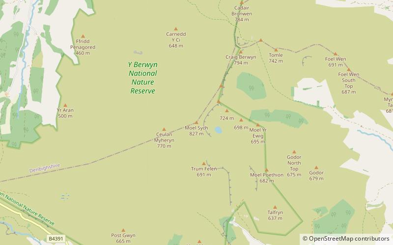
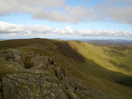
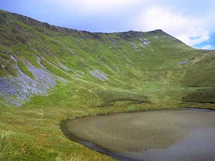
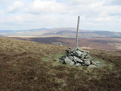
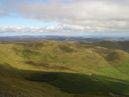
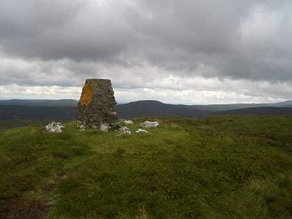
Moel Sych with a height of 826.7 metres is a subsidiary summit of Cadair Berwyn in north east Wales. It is the third highest summit in the Berwyn range after Cadair Berwyn and Cadair Berwyn North Top. ()
WalesUnited Kingdom
Moel Sych plan & book
Unleash the traveler in you — discover the cheapest flight deals, find the perfect hotel or hostel nearby, and search for the best car rental prices. Travel at your own pace to discover new places and enjoy your journey.
Moel Sych – popular in the area (distance from the attraction)
Nearby attractions include: Cadair Berwyn North Top, Cadair Berwyn, Cyrniau Nod, Tomle.
 Nature, Natural attraction, Mountain
Cadair Berwyn North Top
12 min walk • Cadair Berwyn North Top or Cadair Berwyn though an accurate survey in 2014 does suggest Moel Sych may be slightly lower at 826.7 metres.
 Nature, Natural attraction, Cliff
Cadair Berwyn
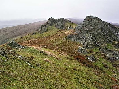
23 min walk • Cadair Berwyn or Cader Berwyn is a mountain summit in north-east Wales with a height of 832 metres above sea level. It is the highest point in the Berwyn range, the highest in North East Wales and the highest significant summit in Wales outside the National Parks.
 Nature, Natural attraction, Mountain
Cyrniau Nod
2 min walk • Cyrniau Nod is a mountain summit in north east Wales. It is a former Marilyn, the Marilyn summit now being the nearby Foel Cedig. Its summit has the Snowdonia National Park boundary running through it. A number of rivers and streams rise from near the mountain including Afon Tanat, Afon Cedig and Nant Ystrad-y-Groes.
 Nature, Natural attraction, Mountain
Tomle
11 min walk • Tomle is a top of Cadair Berwyn in north east Wales. It is the highest of the summits found on the most easterly of Cadair Berwyn's long south ridges. Tomle's summit is boggy and unmarked. To the north, the ridge continues up to Cadair Berwyn North Top. The Craig Berwyn face starting on the west side of the ridge.
 Nature, Natural attraction, Mountain
Foel Wen South Top
11 min walk • Foel Wen South Top is a top of Foel Wen in north east Wales. It is one of the summits found on the most easterly of Cadair Berwyn's long south ridges. The summit is grassy, and unmarked. To the north lies Tomle, while to the south lies its Mynydd Tarw.
 Nature, Natural attraction, Mountain
Llechwedd Du
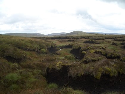
11 min walk • Llechwedd Du is a subsidiary summit of Esgeiriau Gwynion in north Wales. It forms a long peat bog plateau that start at the end of Esgeiriau Gwynion's south ridge, and ends with the higher summit of Moel y Cerrig Duon.
 Nature, Natural attraction, Mountain
Cefn Gwyntog
11 min walk • Cefn Gwyntog is a top of Cyrniau Nod in north east Wales. It forms a part of the Berwyn range known as the Hirnantau. Its summit lies just outside the Snowdonia National Park.
 Nature, Natural attraction, Mountain
Moel y Cerrig Duon
11 min walk • Moel y Cerrig Duon is a subsidiary summit of Esgeiriau Gwynion in Gwynedd in north Wales. Moel y Cerrig Duon tops the eastern end of a long peat bog plateau along with Llechwedd Du. Its summit has a conical shape, rising suddenly from the bog. The summit itself is grassy, marked by a small cairn and a stake.
 Nature, Natural attraction, Mountain
Pen y Boncyn Trefeilw
11 min walk • Pen y Boncyn Trefeilw is a subsidiary summit of Cyrniau Nod in north east Wales. It forms a part of the Berwyn range called the Hirnantau. It has two tops: Stac Rhos and Pen y Cerrig Duon. Pen y Cerrig Duon is now listed as a deleted Nuttall due to re-surveying.
 Nature, Natural attraction, Mountain
Stac Rhos
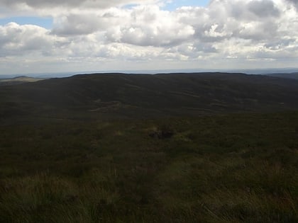
11 min walk • Stac Rhos is a top of Pen y Boncyn Trefeilw in north east Wales. It forms a part of the Berwyn range called the Hirnantau. The views from the summit are extensive, if unremarkable due to the featureless, flat moorland surroundings.
 Nature, Natural attraction, Mountain
Y Groes Fagl
11 min walk • Y Groes Fagl is a top of Cyrniau Nod in north east Wales. It forms a part of the Berwyn range known as the Hirnantau. Its summit has the Snowdonia National Park boundary located just to the east of it.


