Monsal Dale, Peak District

Gallery (4)
Map

Map
Gallery
Facts and practical information
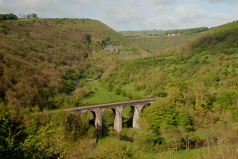
Monsal Dale is a valley in Derbyshire, England, in the White Peak limestone area of the Peak District National Park. It is a Site of Special Scientific Interest, a Special Area of Conservation and part of a Europe-wide network called Natura 2000. ()
Coordinates: 53°14'41"N, 1°43'54"W
Address
Peak District
ContactAdd
Social media
Add
Getting there by public transportation
Public transportation stops near this location
- Bus
 Bus
Bus
- Calculate routeMonsal Head 11 min walk
- Calculate routeLittle Longstone 18 min walk
- Calculate routeCressbrook 24 min walk
- Calculate routeGreat Longstone 29 min walk
Day trips


Frequently Asked Questions (FAQ)
How to get to Monsal Dale by public transport?
The nearest stations to Monsal Dale:
Bus
Bus
- Monsal Head • Lines: 173 (11 min walk)
- Little Longstone • Lines: 173 (18 min walk)