Beinn Chabhair, Loch Lomond and The Trossachs National Park
#71 among attractions in Loch Lomond and The Trossachs National Park


Facts and practical information
Beinn Chabhair is a Scottish mountain. It has fine views down to Loch Lomond. ()
Loch Lomond and The Trossachs National Park United Kingdom
Loch Lomond and The Trossachs National Park plan & book
Unleash the traveler in you — discover the cheapest flight deals, find the perfect hotel or hostel nearby, and search for the best car rental prices. Travel at your own pace to discover new places and enjoy your journey.
Beinn Chabhair – popular in the area (distance from the attraction)
Nearby attractions include: Ben More, Falls of Falloch, Ben Oss, Inveruglas Isle.
 Natural attraction, Mountain
Ben More, Crianlarich
145 min walk • Ben More is a mountain in the southern Highlands of Scotland, near Crianlarich. It is the highest of the so-called Crianlarich Hills to the south-east of the village, and there is no higher land in the British Isles south of Ben More.
 Natural attraction, Park, View point
Falls of Falloch, Loch Lomond and The Trossachs National Park
67 min walk • Falls of Falloch is a waterfall and local beauty spot on the river Falloch off the A82. It is 7 km south-west of the village of Crianlarich in the county of Stirling in Scotland. It is also on the West Highland Way.
 Nature, Natural attraction, Mountain
Ben Oss, Loch Lomond and The Trossachs National Park
172 min walk • Ben Oss is a Scottish mountain situated in the Stirling Council area, six kilometres south west of the village of Tyndrum within the Loch Lomond and the Trossachs National Park.
 Area
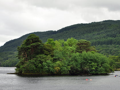
AreaInveruglas Isle, Loch Lomond and The Trossachs National Park
151 min walk • Inveruglas Isle is a small uninhabited island within Loch Lomond, and lies off the shore at Inveruglas opposite Inversnaid at the north end of the loch. It is opposite the Loch Sloy powerstation.
 Nature, Natural attraction, Mountain
Stob Binnein, Loch Lomond and The Trossachs National Park
131 min walk • Stob Binnein is a mountain in the southern Highlands of Scotland, near Crianlarich. It forms a twin-peak with Ben More 3,852 ft, from which it is separated by the Bealach-eadar-dha Beinn, meaning pass between two hills.
 Nature, Natural attraction, Mountain
Cruach Ardrain, Loch Lomond and The Trossachs National Park
84 min walk • Cruach Ardrain is a Munro mountain located in the southern highlands of Scotland in the Stirling Council area, five kilometres south east of Crianlarich.
 Mountain
Stob a' Choin, Loch Lomond and The Trossachs National Park
85 min walk • Stob a'Choin is a mountain in the Grampian Mountains, Scotland, north of Loch Katrine in the Loch Lomond and The Trossachs National Park. The nearest village is Balquhidder.
 Nature, Natural attraction, Mountain
Ben Vorlich, Ardlui
144 min walk • Ben Vorlich is a Scottish mountain situated between the northernmost section of Loch Lomond and Loch Sloy. It is one of the Arrochar Alps, though it lies separate from the other peaks in the range, as indicated by the large topographic prominence.
 Nature, Natural attraction, Mountain
Beinn Dubhchraig, Loch Lomond and The Trossachs National Park
152 min walk • Beinn Dubhchraig is a Scottish mountain eight kilometres west of Crianlarich in the northern part of the Loch Lomond and the Trossachs National Park.
 Nature, Natural attraction, Mountain
An Caisteal, Loch Lomond and The Trossachs National Park
28 min walk • An Caisteal is a Scottish mountain situated six kilometres south of the village of Crianlarich in the Stirling Council area.
 Mountain
Beinn a' Chòin, Loch Lomond and The Trossachs National Park
82 min walk • Beinn a' Choin is a mountain in the Grampian Mountains of Scotland. It lies on the border of the Stirling region and Argyll at the northern end of Loch Lomond. A rugged and wild mountain of rocks and moorland lying north of Ben Lomond, it usually climbed from the small settlement of Inversnaid.


