Worcester city walls, Worcester

Facts and practical information
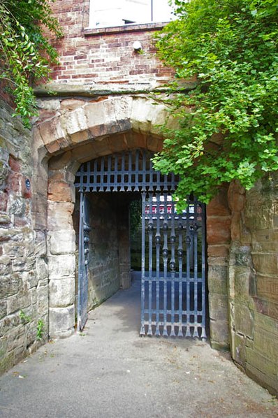
Worcester's city walls are a sequence of defensive structures built around the city of Worcester in England between the 1st and 17th centuries. The first walls to be built around Worcester were constructed by the Romans. These early walls lasted beyond the fall of the Empire, and the defences encouraged several early Christian foundations to establish themselves in Worcester during the troubled 6th and 7th centuries. The Anglo-Saxons expanded Worcester in the 890s, forming a new walled, planned city, called a burh. The burh utilised the southern stretches of the old Roman walls, but pushed further north to enclose a much larger area. The Anglo-Saxon city walls were maintained by a share of taxes on a local market and streets, in an agreement reinforced by a royal charter. ()
Worcester
- Bus
- Train
 Bus
Bus
- Calculate routeCity Walls Road 3 min walk
- Calculate routeCathedral 5 min walk
- Calculate routeSt. Nicholas Street 5 min walk
- Calculate routeAngel Place 7 min walk
- Calculate routeWorcester Foregate Street 8 min walk
- Calculate routeWorcester Shrub Hill 11 min walk


Frequently Asked Questions (FAQ)
Which popular attractions are close to Worcester city walls?
How to get to Worcester city walls by public transport?
Bus
- City Walls Road • Lines: 32, 32B, 332, 44, S44, X44 (3 min walk)
- Cathedral • Lines: 32, 32B, 332, 44 (5 min walk)
Train
- Worcester Foregate Street (8 min walk)
- Worcester Shrub Hill (11 min walk)