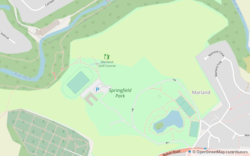
Marland Golf Course, Rochdale

Gallery (1)
Map
Map
Facts and practical information
Marland Golf Course (address: Springfield Park) is a place located in Rochdale (England kingdom) and belongs to the category of golf.
It is situated at an altitude of 459 feet, and its geographical coordinates are 53°36'20"N latitude and 2°11'34"W longitude.
Planning a visit to this place, one can easily and conveniently get there by public transportation. Marland Golf Course is a short distance from the following public transport stations: Castleton (train, 28 min walk).
Among other places and attractions worth visiting in the area are: Denehurst Park (park, 28 min walk), Taylor Park (park, 28 min walk), Spotland Stadium (sport venue, 30 min walk).
Coordinates: 53°36'20"N, 2°11'34"W
Getting there by public transportation
Public transportation stops near this location
- Train
 Train
Train
- Calculate routeCastleton 28 min walk
- Calculate routeHeywood 33 min walk
Day trips


Frequently Asked Questions (FAQ)
How to get to Marland Golf Course by public transport?
The nearest stations to Marland Golf Course:
Train
Train
- Castleton (28 min walk)
- Heywood (33 min walk)