Clifford Road Air Raid Shelter, Ipswich
Map
Facts and practical information
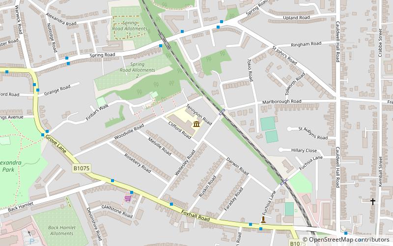
The Clifford Road Air Raid Shelter, located under the playground of Clifford Road Primary School in Ipswich was built during the first months of World War II. It was an unusually solid construction, capable of holding several hundred people. After the war, it was sealed up and largely forgotten. ()
Coordinates: 52°3'19"N, 1°10'34"E
Getting there by public transportation
Public transportation stops near this location
- Bus
- Train
 Bus
Bus
- Calculate routeWellesley Road 4 min walk
- Calculate routeGladstone Road 5 min walk
- Calculate routeBack Hamlet 5 min walk
- Calculate routeFuschia Lane 6 min walk
- Calculate routeDerby Road 12 min walk
Day trips


Frequently Asked Questions (FAQ)
Which popular attractions are close to Clifford Road Air Raid Shelter?
Nearby attractions include Alexandra Park, Ipswich (10 min walk), St Mary, Ipswich (11 min walk), St Helen's Church, Ipswich (13 min walk), Suffolk New College, Ipswich (13 min walk).
How to get to Clifford Road Air Raid Shelter by public transport?
The nearest stations to Clifford Road Air Raid Shelter:
Bus
Train
Bus
- Wellesley Road • Lines: 5, 5E (4 min walk)
- Gladstone Road • Lines: 5, 5E (5 min walk)
Train
- Derby Road (12 min walk)