Queen Elizabeth Sixth Form College, Darlington

Gallery (1)
Map
Map
Facts and practical information
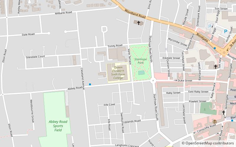
Queen Elizabeth Sixth Form College, or QE as it is commonly known, is a sixth form college on Vane Terrace in Darlington, County Durham, England. It educates nearly 2000 students from Darlington and the surrounding areas with students coming from Stockton, Richmond, Newton Aycliffe and elsewhere. It is situated near the town centre, next to Stanhope Park. ()
Coordinates: 54°31'33"N, 1°33'56"W
Getting there by public transportation
Public transportation stops near this location
- Bus
- Train
 Bus
Bus
- Calculate routeTubwell Row 13 min walk
- Calculate routeDarlington 22 min walk
- Calculate routeNorth Road 22 min walk
Day trips


Frequently Asked Questions (FAQ)
Which popular attractions are close to Queen Elizabeth Sixth Form College?
Nearby attractions include Old Town Hall and Market Hall, Darlington (11 min walk), Darlington Hebrew Congregation, Darlington (12 min walk), North Lodge Park, Darlington (14 min walk), Darlington Town Hall, Darlington (14 min walk).
How to get to Queen Elizabeth Sixth Form College by public transport?
The nearest stations to Queen Elizabeth Sixth Form College:
Bus
Train
Bus
- Tubwell Row • Lines: X66 (13 min walk)
Train
- Darlington (22 min walk)
- North Road (22 min walk)