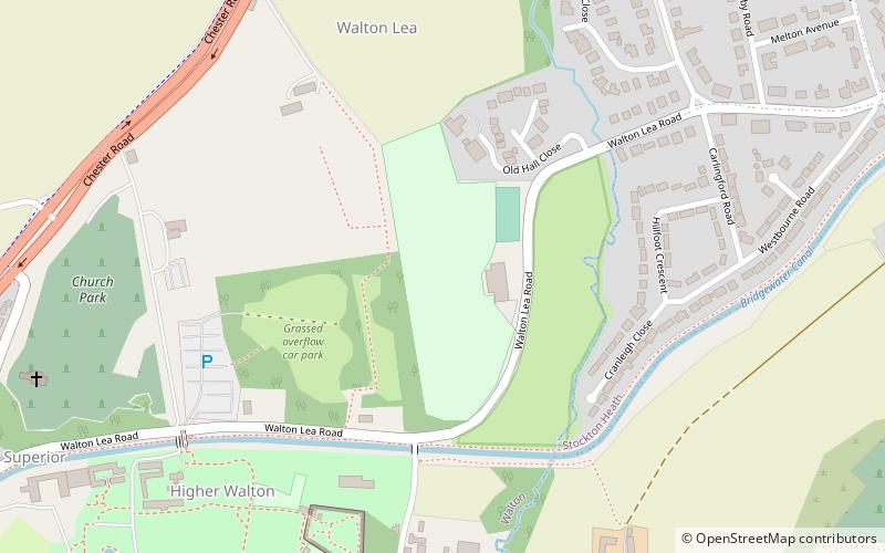
Walton Lea Road, Warrington
Map
Facts and practical information
Walton Lea Road is a cricket ground in Warrington. The first recorded match on the ground was in 1881, when Warrington played Huyton. ()
Coordinates: 53°21'50"N, 2°35'49"W
Address
Warrington
ContactAdd
Social media
Add
Getting there by public transportation
Public transportation stops near this location
- Bus
 Bus
Bus
- Calculate routeWalton Stag Inn 11 min walk
- Calculate routeThe Vicarage 14 min walk
- Calculate routeCentral Avenue 31 min walk
Day trips


Frequently Asked Questions (FAQ)
Which popular attractions are close to Walton Lea Road?
Nearby attractions include St John the Evangelist's Church, Warrington (9 min walk), Walton Hall, Warrington (9 min walk), St Thomas' Church, Warrington (22 min walk), Stockton Heath, Warrington (23 min walk).
How to get to Walton Lea Road by public transport?
The nearest stations to Walton Lea Road:
Bus
Bus
- Walton Stag Inn • Lines: 62 (11 min walk)
- The Vicarage • Lines: 62 (14 min walk)