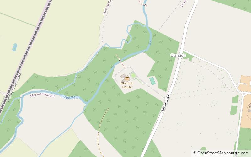
Olantigh, Kent Downs
Map
Facts and practical information
Olantigh is a house 1 mile north of Wye in Kent, southeast England. It includes a garden of 20 acres. The hamlet in which the property stands is Little Olantigh. The population of the property and surrounding area is included in the civil parish of Wye with Hinxhill. ()
Elevation: 112 ft a.s.l.Coordinates: 51°11'55"N, 0°56'47"E
Address
Kent Downs
ContactAdd
Social media
Add
Getting there by public transportation
Public transportation stops near this location
- Train
 Train
Train
- Calculate routeWye 30 min walk
Day trips


Frequently Asked Questions (FAQ)
How to get to Olantigh by public transport?
The nearest stations to Olantigh:
Train
Train
- Wye (30 min walk)