Trek Zone

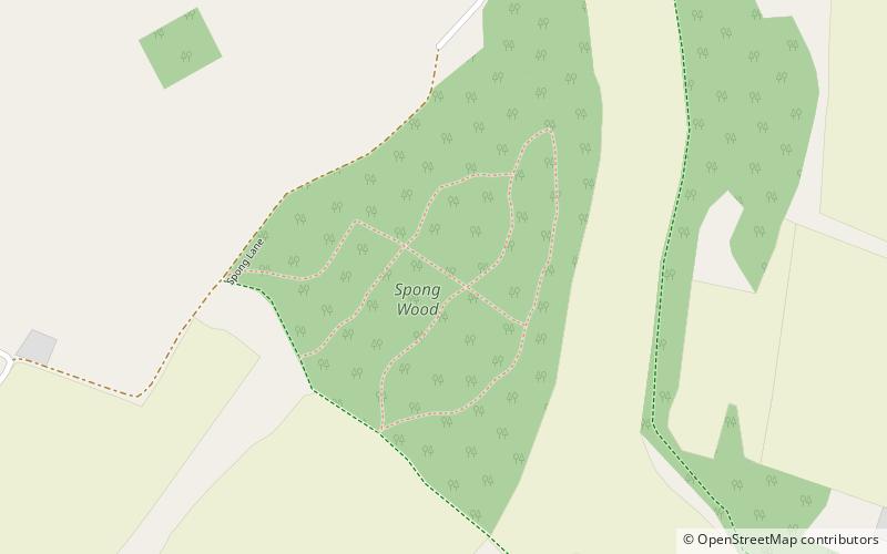
Spong Wood, Kent Downs

#17 among attractions in Kent Downs

Park
Spong Wood location map
Map

Facts and practical information

Elevation: 413 ft a.s.l.Coordinates: 51°10'9"N, 1°2'17"E
Address

Kent Downs United Kingdom

ContactAdd
Social media
Add
Day trips

Spong Wood – popular in the area (distance from the attraction)

Nearby attractions include: Stour Valley Walk, Cheriton Hill, Jumping Downs, Elham Valley.

  • stour valley walk4 miNW
  • cheriton hill kent downs5.8 miSE
  • jumping downs kent downs4.6 miNE
  • elham valley3.3 miE
  • farthing common3 miS
  • olantigh kent downs location map
    4.5 miNW
  • elham valley line trust railway museum and countryside centre folkestone6 miSE
  • lyminge abbey location map
    3.7 miSE
  • davisons mill1.6 miNE
  • denge wood4.2 miN
  • julliberries grave5.6 miNW

Where to next? Visit england England region page or discover the top tourist attractions in United Kingdom.