Marks & Co, London
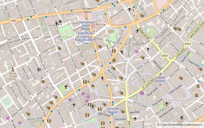
Map
Facts and practical information
Marks & Co, also incorrectly referred to as "Marks & Company" or colloquially as "84", was a well-known antiquarian bookseller located at Cambridge Circus - 84, Charing Cross Road, London. ()
Coordinates: 51°30'49"N, 0°7'45"W
Address
Camden (Holborn and Covent Garden)London
ContactAdd
Social media
Add
Getting there by public transportation
Public transportation stops near this location
- Metro
- Bus
- Train
- Ferry
 Metro
Metro
- Calculate routeCambridge Circus 2 min walk
- Calculate routeDenmark Street 2 min walk
- Calculate routeGerrard Place / Chinatown 3 min walk
- Calculate routeDean Street / Chinatown 4 min walk
- Calculate routeLeicester Square 4 min walk
- Calculate routeTottenham Court Road 5 min walk
- Calculate routeCovent Garden 6 min walk
- Calculate routePiccadilly Circus 9 min walk
- Calculate routeCharing Cross 13 min walk
- Calculate routeLondon Waterloo 27 min walk
- Calculate routeLondon Euston 28 min walk
- Calculate routeCity Thameslink 29 min walk
- Calculate routeEmbankment 15 min walk
- Calculate routeFestival Pier 18 min walk
- Calculate routeLondon Eye - Waterloo Pier 21 min walk
- Calculate routeWestminster Pier 22 min walk
Maps Tube
Tube
TubeDay trips


Frequently Asked Questions (FAQ)
Which popular attractions are close to Marks & Co?
Nearby attractions include Cambridge Circus, London (1 min walk), West End of London, London (1 min walk), Palace Theatre, London (2 min walk), Bunjies, London (2 min walk).
How to get to Marks & Co by public transport?
The nearest stations to Marks & Co:
Bus
Metro
Train
Ferry
Bus
- Cambridge Circus • Lines: 38, N38 (2 min walk)
- Denmark Street • Lines: 38, N38 (2 min walk)
Metro
- Leicester Square • Lines: Northern, Piccadilly (4 min walk)
- Tottenham Court Road • Lines: Central, Northern (5 min walk)
Train
- Charing Cross (13 min walk)
- London Waterloo (27 min walk)
Ferry
- Embankment • Lines: Green Tour, Rb1, Rb1X, Rb2, Rb6 (15 min walk)
- Festival Pier • Lines: Green Tour (18 min walk)