Stob Dubh, Ben Nevis and Glen Coe National Scenic Area
#2 among attractions in Ben Nevis and Glen Coe National Scenic Area

Facts and practical information
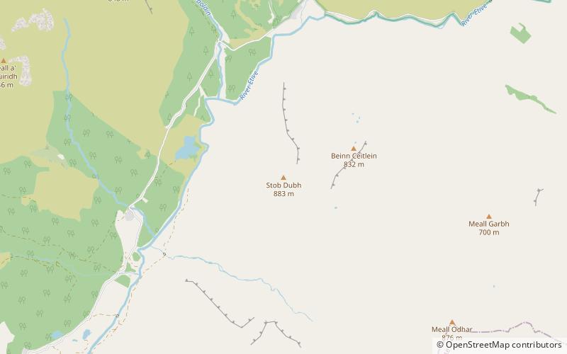
Stob Dubh is a mountain in the Grampian Mountains of Scotland, at the head of Loch Etive north of the village of Taynuilt. ()
Ben Nevis and Glen Coe National Scenic Area United Kingdom
Ben Nevis and Glen Coe National Scenic Area plan & book
Unleash the traveler in you — discover the cheapest flight deals, find the perfect hotel or hostel nearby, and search for the best car rental prices. Travel at your own pace to discover new places and enjoy your journey.
Stob Dubh – popular in the area (distance from the attraction)
Nearby attractions include: Buachaille Etive Mòr, Stob Ghabhar, Beinn Mhic Chasgaig, Glas Bheinn Mhòr.
 Climbing
Buachaille Etive Mòr
126 min walk • Buachaille Etive Mòr, an iconic mountain located in the Highlands of Scotland, is a revered climbing spot that commands the respect and admiration of mountaineers from around the world. Known colloquially as "The Buachaille," this pyramidal peak forms part of the...
 Nature, Natural attraction, Mountain
Stob Ghabhar
114 min walk • Stob Ghabhar is a Scottish mountain nine kilometres north west of Bridge of Orchy. It is part of the Black Mount group of mountains and stands on the border of the Argyll and Bute and Highland council areas.
 Mountain
Beinn Mhic Chasgaig, Ben Nevis and Glen Coe National Scenic Area
90 min walk • Beinn Mhic Chasgaig is a mountain in the Grampian Mountains of Scotland. It lies near the head of Glen Etive in Highland. A steep and craggy peak, it is surrounded by high Munros and provides a very steep and challenging climb to its summit.
 Mountain
Glas Bheinn Mhòr, Ben Nevis and Glen Coe National Scenic Area
96 min walk • Glas Bheinn Mhor is a mountain in the Grampian Mountains of Scotland, south of Glen Etive. The Argyll and Bute and Highland border straddles its summit. A conical mountain, it forms part of the Ben Starav range and lies east of the mighty Starov itself.
 Mountain
Beinn nan Aighenan, Ben Nevis and Glen Coe National Scenic Area
134 min walk • Beinn nan Aighenan is a 960-metre high mountain in the Grampian Mountains of Scotland. It lies in Argyll and Bute, north of the village of Taynuilt.
 Mountain
Stob Coir' an Albannaich, Ben Nevis and Glen Coe National Scenic Area
72 min walk • Stob Coir' an Albannaich is a mountain in the Grampian Mountains of Scotland. It lies on the border of Argyll and Bute and the Highlands area, south of Glen Etive. The mountain makes for a fine traverse. The closest village is Taynuilt to the south.
 Nature, Natural attraction, Lake
Loch Achtriochtan, Glencoe
131 min walk • Loch Achtriochtan or Loch Trychardan is a Scottish loch located to the east of Glencoe village in the Scottish Highlands. It is now under the care of the National Trust for Scotland.
 Nature, Natural attraction, Mountain
Meall a' Bhùiridh
136 min walk • Meall a' Bhùiridh is a mountain on the edge of Rannoch Moor in the Highlands of Scotland. It lies near the top of Glen Coe and Glen Etive, overlooking the Kings House Hotel inn and the A82 road. The Glencoe Ski area is located on the northern slopes of the peak.
 Nature, Natural attraction, Mountain
Stob Coire Sgreamhach
79 min walk • Stob Coire Sgreamhach is a mountain in Scotland, forming part of the Bidean nam Bian massif on the southern side of Glen Coe. It is often considered a subsidiary peak of Bidean, though since the 1997 revision of Munros Tables it has been classified as a separate Munro.
 Nature, Natural attraction, Mountain
Ben Starav
116 min walk • Ben Starav is a Scottish mountain in the Highlands lying south of Glen Etive that rises to its full 1,078-metre height above Loch Etive at its western foot.
 Mountain
Meall nan Eun, Ben Nevis and Glen Coe National Scenic Area
74 min walk • Meall nan Eun is a mountain in the Grampian Mountains of Scotland. It is located east of Glen Etive in Argyll and Bute. A dome like mountain with a rounded top but steep sides, it has a summit plateau.


