Sheffield urban area, Sheffield
Map
Facts and practical information
The Sheffield Urban Area is a conurbation in the North of England with a population of 685,368 according to the 2011 census. This was a 7% increase on the 2001 population of 640,720 making it the 8th largest conurbation in the United Kingdom and England's 6th largest. Named the Sheffield Urban Area by the Office for National Statistics, it must not be confused with the Sheffield City Region, a non-government term, although often used, particularly by the business community. In 2001 the population density of the urban area was 3,949.2 people per km2 by 2011 this had increased slightly to 4,092 people per km2. ()
Coordinates: 53°23'42"N, 1°27'18"W
Address
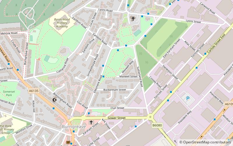
BurngreaveSheffield
ContactAdd
Social media
Add
Getting there by public transportation
Public transportation stops near this location
- Bus
- Tram
- Train
 Bus
Bus
- Calculate routeEllesmere Road/Buckenham Street 2 min walk
- Calculate routeEarldom Street/Sutherland Road 3 min walk
- Calculate routeHyde Park 19 min walk
- Calculate routeCricket Inn Road 22 min walk
- Calculate routeNunnery Square 22 min walk
- Calculate routeFitzalan Square / Ponds Forge 23 min walk
- Calculate routeSheffield 31 min walk
Day trips


Frequently Asked Questions (FAQ)
Which popular attractions are close to Sheffield urban area?
Nearby attractions include Christ Church, Sheffield (11 min walk), Abbeyfield Park, Sheffield (13 min walk), Wicker Arches, Sheffield (14 min walk), Cobweb Bridge, Sheffield (14 min walk).
How to get to Sheffield urban area by public transport?
The nearest stations to Sheffield urban area:
Bus
Tram
Train
Bus
- Ellesmere Road/Buckenham Street • Lines: 5, 97, 98 (2 min walk)
- Earldom Street/Sutherland Road • Lines: 5, 97, 98 (3 min walk)
Tram
- Hyde Park • Lines: Tt, Yell (19 min walk)
- Cricket Inn Road • Lines: Tt, Yell (22 min walk)
Train
- Sheffield (31 min walk)