Ingleton Coalfield, Ingleton
#1 among attractions in Ingleton
Facts and practical information
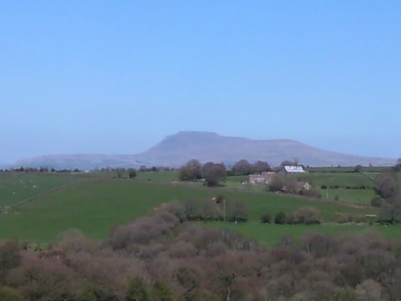
The Ingleton Coalfield is in North Yorkshire, close to its border with Lancashire in north-west England. Isolated from other coal-producing areas, it is one of the smallest coalfields in Great Britain. ()
Ingleton United Kingdom
Ingleton Coalfield – popular in the area (distance from the attraction)
Nearby attractions include: White Scar Cave, Ingleborough, Ingleton Pottery, Swinsto Cave.
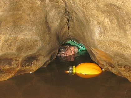
 Natural attraction, Cave, Park
White Scar Cave, Yorkshire Dales National Park
53 min walk • White Scar Caves is a show cave in the civil parish of Ingleton, North Yorkshire, England, under Ingleborough in the Chapel-le-Dale valley of the Yorkshire Dales National Park. It is a solutional resurgence cave formed in Carboniferous limestone, some 6 kilometres long.
 Flat-topped peak with fortress ruins
Ingleborough, Settle
91 min walk • Ingleborough is the second-highest mountain in the Yorkshire Dales, England. It is one of the Yorkshire Three Peaks, and is frequently climbed as part of the Three Peaks walk.
 Nature, Natural attraction, Shopping
Ingleton Pottery, Yorkshire Dales National Park
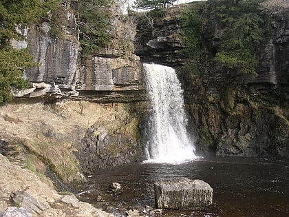
21 min walk • Ingleton Waterfalls Trail is a well-known circular trail beginning and ending in the village of Ingleton in the English county of North Yorkshire, now maintained by the Ingleton Scenery Company.
 Cave
CaveSwinsto Cave, Yorkshire Dales
86 min walk • Swinsto Cave is a limestone cave in West Kingsdale, North Yorkshire, England. It leads into Kingsdale Master Cave and it is popular with cavers as it is possible to descend by abseiling down the pitches, retrieving the rope each time, and exiting through Valley Entrance of Kingsdale Master Cave at the base of the hill.
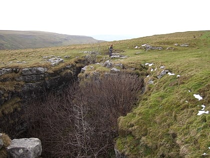 Nature, Natural attraction, Cave
Rowten Pot, Yorkshire Dales National Park
94 min walk • Rowten Pot is one of several entrances into the 27-kilometre long cave system that drains Kingsdale in North Yorkshire, England. Its entrance is a shaft some 27 metres long, 10 metres wide, and at the southern end 72 metres deep.
 Rock, Nature, Natural attraction
Great Stone of Fourstones
98 min walk • The Great Stone of Fourstones, or the "Big Stone" as it is known locally, is a glacial deposit on the moorlands of Tatham Fells, England, straddling the county border between North Yorkshire and Lancashire, near Bentham in the District of Craven.
 Gothic Revival architecture, Church, Gothic architecture
St Oswald's Church, Yorkshire Dales National Park
25 min walk • St Oswald's Church is in the village of Thornton in Lonsdale, North Yorkshire, England. It is an active Anglican parish church in the deanery of Ewecross, the archdeaconry of Craven and the Diocese of Leeds.
 Church, Gothic Revival architecture
St Margaret's Church, Bentham
61 min walk • St Margaret's Church is in Station Road, High Bentham, North Yorkshire, England. It is an Anglican parish church in the deanery of Ewecross, the archdeaconry of Craven, and the Diocese of Leeds. Its benefice is united with that of St John the Baptist, Low Bentham.
 Church
All Saints Church
61 min walk • All Saints Church is in the village of Burton in Lonsdale, North Yorkshire, England. It is an active Anglican parish church in the deanery of Ewecross, the archdeaconry of Craven, and the Diocese of Leeds.
 Nature, Natural attraction, Cave
Disappointment Pot, Yorkshire Dales National Park
97 min walk • Disappointment Pot is one of the entrances to the Gaping Gill cave system, located in a steep grassy shakehole some 120 metres south-east of Gaping Gill Main Shaft.
 Nature, Natural attraction, Cave
Stream Passage Pot, Yorkshire Dales National Park
94 min walk • Stream Passage Pot is one of the entrances to the Gaping Gill system being located about 320 metres ESE of Gaping Gill Main Shaft. It is a popular and sporting entrance into the system, featuring three well-watered big shafts.