Frimley Park, Camberley
Map
Facts and practical information
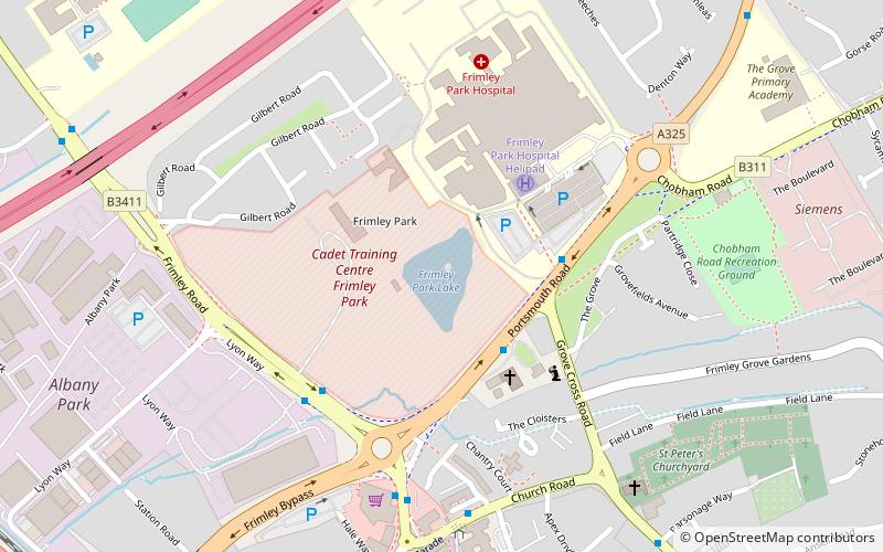
Frimley Park in Frimley, Surrey, England, consists of Frimley Park mansion, a Grade II listed building, and the formal gardens, designed by Edward White in 1920. The house and gardens are all that remain of an estate that once encompassed more than 590 hectares. Since 1949 it has belonged to the War Office, and currently hosts an Army Cadet training centre. ()
Coordinates: 51°19'3"N, 0°44'35"W
Address
FrimleyCamberley
ContactAdd
Social media
Add
Getting there by public transportation
Public transportation stops near this location
- Bus
- Train
 Bus
Bus
- Calculate routeThe Grove 3 min walk
- Calculate routeFrimley Park Hospital 3 min walk
- Calculate routeLyon Way 4 min walk
- Calculate routeFrimley 12 min walk
- Calculate routeFarnborough North 27 min walk
Day trips


Frequently Asked Questions (FAQ)
How to get to Frimley Park by public transport?
The nearest stations to Frimley Park:
Bus
Train
Bus
- The Grove • Lines: 500 (3 min walk)
- Frimley Park Hospital • Lines: 48, 500 (3 min walk)
Train
- Frimley (12 min walk)
- Farnborough North (27 min walk)