Nottingham & Union Rowing Club, Nottingham
Map
Facts and practical information
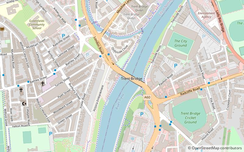
Nottingham & Union Rowing Club is a rowing club on the River Trent, based at Trentside, West Bridgford, Nottingham, Nottinghamshire. ()
Coordinates: 52°56'19"N, 1°8'13"W
Address
Trentside NorthBridgeNottingham
ContactAdd
Social media
Add
Getting there by public transportation
Public transportation stops near this location
- Bus
- Tram
- Train
 Bus
Bus
- Calculate routeCricket Ground 6 min walk
- Calculate routeCounty Hall 5 min walk
- Calculate routeBunbury Street 6 min walk
- Calculate routeQueens Walk 16 min walk
- Calculate routeNottingham Station 18 min walk
- Calculate routeMeadows Embankment 18 min walk
- Calculate routeWilford Village 21 min walk
- Calculate routeNottingham 18 min walk
Day trips


Frequently Asked Questions (FAQ)
Which popular attractions are close to Nottingham & Union Rowing Club?
Nearby attractions include Trent Bridge, Nottingham (1 min walk), Meadow Lane Stadium, Nottingham (8 min walk), St Faith's Church, Nottingham (8 min walk), City War Memorial, Nottingham (9 min walk).
How to get to Nottingham & Union Rowing Club by public transport?
The nearest stations to Nottingham & Union Rowing Club:
Bus
Tram
Train
Bus
- Cricket Ground • Lines: 11, 11C, 5, 6, 7, 8, 9, 90, Cotgrave Connection, L22, L23, (N) N6, Rushcliffe Mainline, Rushcliffe Villager (6 min walk)
- County Hall • Lines: 1, 10, 19, 2, 3, 4, 9, Keyworth Connection, L1, N4, Skylink Express (5 min walk)
Tram
- Queens Walk • Lines: 2 (16 min walk)
- Nottingham Station • Lines: 1, 2 (18 min walk)
Train
- Nottingham (18 min walk)