Trek Zone

Roxby Hall, Staithes

#1 among attractions in Staithes

Ruins
Roxby Hall location map
Map

Facts and practical information
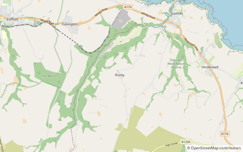
Coordinates: 54°32'6"N, 0°49'25"W
Address

Staithes United Kingdom

ContactAdd
Social media
Add
Day trips

Roxby Hall – popular in the area (distance from the attraction)

Nearby attractions include: Church of St Oswald, Hob Holes, Esk Valley Walk, Mulgrave Castle.

  • church of st oswald north york moors5.8 miE
  • hob holes runswick bay3.3 miE
  • esk valley walk north york moors6.7 miSW
  • mulgrave castle north york moors5.5 miSE
  • scaling dam reservoir north york moors2.3 miSW
  • street house anglo saxon cemetery2.3 miNW
  • the moors national park centre danby5.6 miSW
  • eskdale north york moors4.2 miS
  • pinkney and gerrick woods north york moors location map
    3.6 miSW
  • sandsend tunnel runswick bay4.9 miE
  • woodsmith mine tunnel north york moors4.2 miSW

Where to next? Visit england England region page or discover the top tourist attractions in United Kingdom.