Coventry Zoo, Coventry
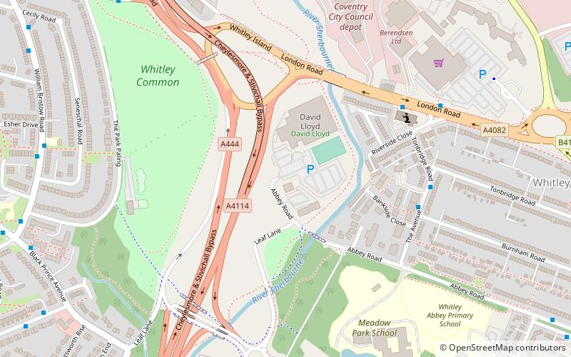
Map
Facts and practical information
Coventry Zoo was a zoo located in Whitley, Coventry, England. Its owners and directors were members of the famous Chipperfield circus family. ()
Coordinates: 52°23'22"N, 1°29'25"W
Address
South Coventry (Cheylesmore)Coventry
ContactAdd
Social media
Add
Getting there by public transportation
Public transportation stops near this location
- Bus
- Train
 Bus
Bus
- Calculate routeThe Avenue / Burnham Rd 5 min walk
- Calculate routeLondon Rd / Riverside Close 5 min walk
- Calculate routeLeaf Lane / Jaguar Works 7 min walk
- Calculate routeWilliam Bristow Rd / Esher Drive 8 min walk
- Calculate routeCoventry 33 min walk
Day trips


Frequently Asked Questions (FAQ)
Which popular attractions are close to Coventry Zoo?
Nearby attractions include London Road Cemetery, Coventry (16 min walk), The Charterhouse, Coventry (21 min walk).
How to get to Coventry Zoo by public transport?
The nearest stations to Coventry Zoo:
Bus
Train
Bus
- The Avenue / Burnham Rd • Lines: 41 (5 min walk)
- London Rd / Riverside Close • Lines: 21, 21A, 41, 60 (5 min walk)
Train
- Coventry (33 min walk)