Vandalian Tower, Petersfield
#6 among attractions in Petersfield
![Vandalian Tower location map](https://tzmedia.b-cdn.net/media/images/static-maps/gb/50_95821_-0_88318.jpg)
![Vandalian Tower, Petersfield](https://tzmedia.b-cdn.net/media/images/gb/place/gallery/medium/f4081e179a91a1132f4a10cbf6104239.jpg)
Facts and practical information
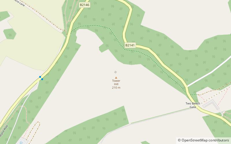
The Vandalian Tower at Harting, West Sussex, England, is an 18th-century folly, built to commemorate the British colony of Vandalia, a short-lived colony that disappeared with the spread of America. It sits on the summit of Tower Hill. ()
Petersfield United Kingdom
Vandalian Tower – popular in the area (distance from the attraction)
Nearby attractions include: Uppark, Buriton Chalk Pit, Petersfield Museum, Flora Twort Gallery.
0.5 miSWMuseum, Vernacular architecture, History museumUppark, Petersfield
14 min walk • Uppark is a 17th-century house in South Harting, West Sussex, England. It is a Grade I listed building and a National Trust property.
3.3 miWParkBuriton Chalk Pit, Petersfield
85 min walk • Buriton Chalk Pit is a 5.7-hectare Local Nature Reserve near Buriton in Hampshire. It is owned by East Hampshire District Council and managed by Hampshire Countryside Service.
3.9 miNWMilitary museum, History museum, TownPetersfield Museum, Petersfield
99 min walk • Petersfield Museum is a local museum in the small town of Petersfield in Hampshire, England. Petersfield Museum Limited is a registered charity.
3.9 miNWArt gallery, Shopping, MuseumFlora Twort Gallery, Petersfield
100 min walk • Petersfield Museum is a local museum in the small town of Petersfield in Hampshire, England. Petersfield Museum Limited is a registered charity.
3.9 miNWChurchSt Peter's Church, Petersfield
100 min walk • St Peter's Church is the Anglican parish church in Petersfield, Hampshire, England. It is within the Diocese of Portsmouth. The ancient church, a Grade I listed building, is located in the centre of the town, on the south side of the Square.
2.6 miEArchaeological siteThe Devil's Jumps, Sussex Downs AONB
67 min walk • The Devil's Jumps are a group of five large bell barrows situated on the South Downs 1.2 kilometres south-east of Treyford in the county of West Sussex in southern England. The Devil's Jumps site is listed as a Scheduled Ancient Monument and as a Local Nature Reserve.
1.4 miNForts and castlesTorberry Hill, Sussex Downs AONB
35 min walk • Torberry Hill is an Iron Age hillfort in the county of West Sussex, in southern England. It is a Scheduled Ancient Monument, with a list entry identification number of 1015966.
1.4 miEArchaeological siteBeacon Hill, Sussex Downs AONB
35 min walk • Beacon Hill, also known as Harting Beacon, is a hillfort on the South Downs, in the county of West Sussex in southern England. The hillfort is located in the parish of Elsted and Treyford, in Chichester District. It is a Scheduled Ancient Monument with a list entry identification number of 1015915.
3 miWNature, Natural attraction, HillHead Down, South Downs National Park
77 min walk • Head Down is one of the highest points in the county of Hampshire, England, and in the South Downs, rising to 205 metres above sea level. The tree-covered Head Down rises about 1 kilometre south of the village of Buriton in Hampshire.
3.8 miWNature, Natural attraction, HillWar Down, South Downs National Park
97 min walk • At 244 metres, War Down is one of the highest hills in the county of Hampshire, England and the second highest summit in the Hampshire part of the South Downs. Just 1 kilometre to the northwest is the South Downs' highest point at Butser Hill. Much of the hill is covered in mixed forest and there is a trig point at 244 metres.
0.9 miEParkHarting Downs, Petersfield
25 min walk • Harting Downs is a 336.3-hectare biological Site of Special Scientific Interest west of Midhurst in West Sussex. It is a Nature Conservation Review site, Grade I and an area of 206.6 hectares is a Local Nature Reserve which is owned and managed by the National Trust.