Trek Zone

Gloucester Rowing Club, Gloucester

#83 among attractions in Gloucester

Sport, Sport venue
Gloucester Rowing Club location map
Map

Facts and practical information
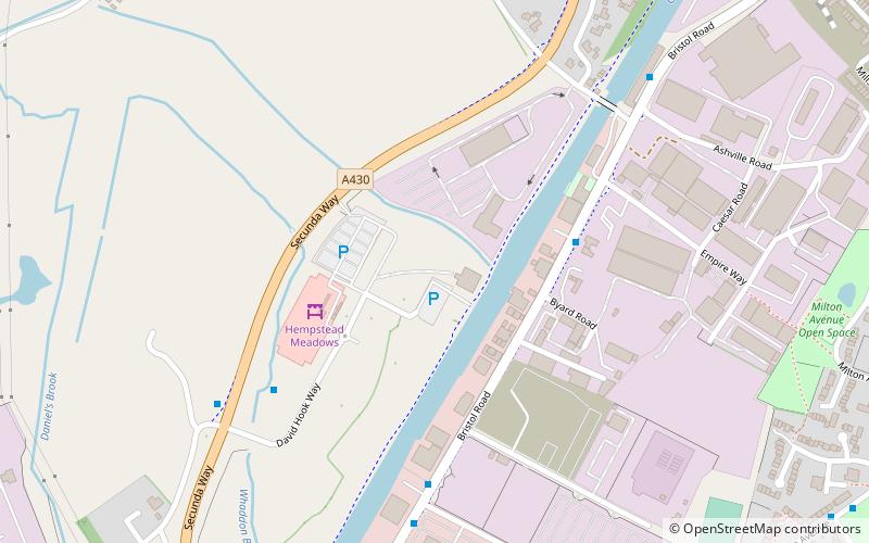
Coordinates: 51°50'38"N, 2°16'3"W
Address

Gloucester United Kingdom

ContactAdd
Social media
Add
Day trips

Gloucester Rowing Club – popular in the area (distance from the attraction)

Nearby attractions include: Gloucester Quays Outlet, Gloucester Waterways Museum, Llanthony Road Bridge, High Orchard Bridge.

  • gloucester quays outlet1.3 miNE
  • gloucester waterways museum1.4 miNE
  • llanthony road bridge gloucester location map
    1.4 miNE
  • high orchard bridge gloucester1.1 miNE
  • llanthony secunda gloucester1.2 miN
  • st paul and st stephens church gloucester1.2 miNE
  • spa road gloucester1.4 miNE
  • our ladys well gloucester0.7 miN
  • gloucester national spiritualist church1.5 miNE
  • st barnabas church gloucester1.1 miE
  • bristol road gloucester0.8 miNE

Frequently Asked Questions (FAQ)

Which popular attractions are close to Gloucester Rowing Club?

Nearby attractions include Podsmead, Gloucester (15 min walk), Up Close Photography, Gloucester (15 min walk), Our Lady's Well, Gloucester (19 min walk), Bristol Road, Gloucester (21 min walk).

Where to next? Visit england England region page or discover the top tourist attractions in United Kingdom.