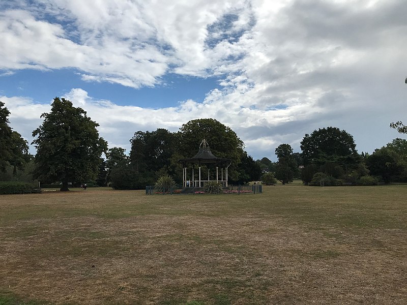
Bowie Bandstand
#1179 among destinations in the United Kingdom

Facts and practical information
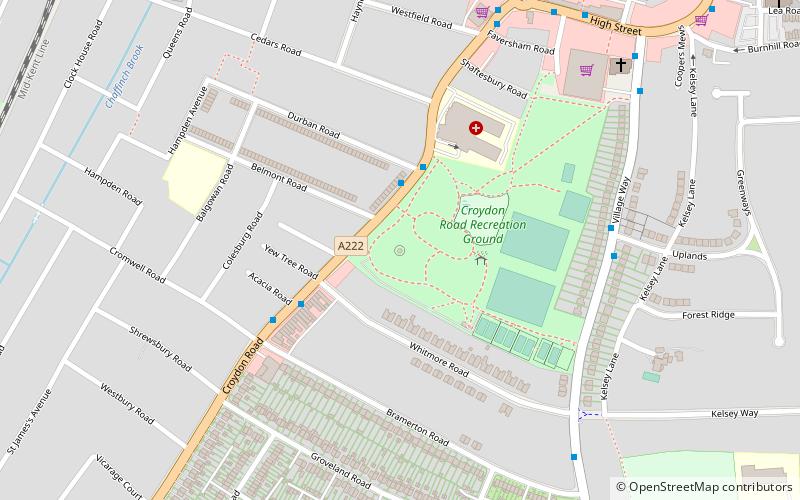
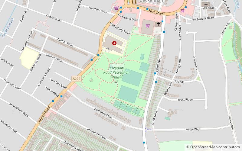
The Bowie Bandstand is a listed building in Croydon Road Recreation Ground, a public park in Beckenham in the London Borough of Bromley. ()
EnglandUnited Kingdom
Bowie Bandstand plan & book
Unleash the traveler in you — discover the cheapest flight deals, find the perfect hotel or hostel nearby, and search for the best car rental prices. Travel at your own pace to discover new places and enjoy your journey.
Bowie Bandstand – popular in the area (distance from the attraction)
Nearby attractions include: County Cricket Ground, Beckenham Bookshop, Beckenham Place Park, South Norwood Country Park.
 Sport venue, Sport
County Cricket Ground, London
30 min walk • The County Ground, Beckenham is a cricket ground in Beckenham in the London Borough of Bromley. The ground is owned by Leander Sports and Leisure and is used as an outground by Kent County Cricket Club for First XI fixtures, as well as for other matches.
 Church, Gothic Revival architecture
Beckenham Bookshop
15 min walk • St George's Church, Beckenham is the Church of England parish church of Beckenham, Greater London. It is Grade II* listed. St George's Church is the principal parish church, and is in the centre of Beckenham. Originally medieval, it has been extensively rebuilt.
 Park
ParkBeckenham Place Park, London
36 min walk • Beckenham Place Park is a large park located near Beckenham in the London Borough of Lewisham. It lies close to the border with the London Borough of Bromley.
 Park
ParkSouth Norwood Country Park, London
28 min walk • South Norwood Country Park is a park in South Norwood, close to Elmers End and Birkbeck train stations. The historic Kent-Surrey border runs through the site, and since 1965 it has been located wholly in the London Borough of Croydon.
 Park
ParkCroydon Road Recreation Ground
3 min walk • Croydon Road Recreation Ground is a public park located in Beckenham in the London Borough of Bromley. It is near the High St and adjacent to Beckenham Beacon. The park features a café and bandstand, as well as a bowling green and other sports facilities.
 Park, Lake
Kelsey Park, London
15 min walk • Kelsey Park is a public park in Beckenham in the borough of Bromley, Greater London. It historically formed the landscaped park of the Kelsey Manor Estate. The river Beck runs through it.
 Neighbourhood
London Borough of Lewisham, London
24 min walk • Lewisham is a London borough in south-east London; it forms part of Inner London. The principal settlement of the borough is Lewisham. The local authority is Lewisham London Borough Council, based in Catford. The Prime Meridian passes through Lewisham.
 Town, Neighbourhood
Beckenham, London
16 min walk • Beckenham is a town in Greater London, England, within the London Borough of Bromley. It is located 8.4 miles south-east of Charing Cross, situated north of Elmers End and Eden Park, east of Penge, south of Lower Sydenham and Bellingham, and west of Bromley and Shortlands.
 Area
AreaShortlands, London
25 min walk • Shortlands is a suburb of South East London, England, within the London Borough of Bromley and the historic county of Kent. It is located between Beckenham and Bromley, to the north of Park Langley.

 Neighbourhood
Elmers End, Warlingham
23 min walk • Elmers End is an area of south-east London, England, within the London Borough of Bromley and the historic county of Kent. It is located south of Beckenham, west of Eden Park, north of Monks Orchard and east of Anerley.


