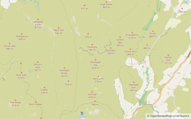
Randygill Top, Yorkshire Dales National Park
#84 among attractions in Yorkshire Dales National Park
Facts and practical information
Randygill Top is a mountain located in the Howgill Fells, Cumbria, England. ()
Yorkshire Dales National Park United Kingdom
Randygill Top – popular in the area (distance from the attraction)
Nearby attractions include: Sunbiggin Tarn, Sedbergh People's Hall, St Oswald's Church, St Andrew's Church.
 Lake
LakeSunbiggin Tarn, Kirkby Stephen
123 min walk • Sunbiggin Tarn is a tarn near Sunbiggin in Cumbria. It is in a Site of Special Scientific Interest which also includes the surrounding moorland and limestone pavement of Little Asby Scar.
 Park
ParkSedbergh People's Hall, Sedbergh
134 min walk • Sedbergh People's Hall is a village hall in Sedbergh, unique because it was built by the people, for the people.
 Church
St Oswald's Church, Yorkshire Dales National Park
87 min walk • St Oswald's Church is in the village of Ravenstonedale, Cumbria, England. It is an active Anglican parish church in the deanery of Appleby, the archdeaconry of Carlisle, and the diocese of Carlisle.
 Church, Gothic architecture
St Andrew's Church, Sedbergh
135 min walk • St Andrew's Church is in Main Street, Sedbergh, Cumbria, England. It is an active Anglican parish church in the deanery of Kendal, and the diocese of Carlisle. Its benefice is united with those of St Mark, Cautley, and St John the Baptist, Garsdale, to form the benefice of Sedbergh, Cautley and Garsdale.
 Church, Gothic Revival architecture
Sedbergh School Chapel, Sedbergh
139 min walk • Sedbergh School Chapel is located to the southeast of Sedbergh School, Sedbergh, Cumbria, England. It is considered to be of architectural importance and is recorded in the National Heritage List for England as a designated Grade II* listed building.
 Monuments and statues, Church
Brigflatts Meeting House, Sedbergh
159 min walk • Brigflatts Meeting House or Briggflatts Meeting House is a Friends Meeting House of the Religious Society of Friends, near Sedbergh, Cumbria, in north-western England. Built in 1675, it is the second oldest Friends Meeting House in England. It has been listed Grade I on the National Heritage List for England since March 1954.
 Nature, Natural attraction, Waterfall
Cautley Spout, Sedbergh
54 min walk • Cautley Spout is England's highest waterfall above ground. The broken cascade of falls tumbles a total of 650 feet down a cliff face at the head of a wild and bleak glacial valley that comes down from a high plateau called The Calf.
 Nature, Natural attraction, Mountain
Wild Boar Fell, Yorkshire Dales National Park
114 min walk • Wild Boar Fell is a mountain in the Yorkshire Dales National Park, on the eastern edge of Cumbria, England. At 2,323 feet, it is either the 4th-highest fell in the Yorkshire Dales or the 5th, depending on whether nearby High Seat is counted or not.
 Nature, Natural attraction, Mountain
The Calf, Yorkshire Dales National Park
58 min walk • The Calf, at 676 m, is the highest top in the Howgill Fells, an area of high ground in the north-west of the Yorkshire Dales in the county of Cumbria.
 Church
St Gregory's Church, Yorkshire Dales National Park
150 min walk • St Gregory's Church, Vale of Lune, also known as the Vale of Lune Chapel, is a redundant Anglican church situated on the A684 road about 1.5 miles to the west of Sedbergh, Cumbria, England.
 Nightlife
The Bull Hotel, Sedbergh
134 min walk • The Bull Hotel, formerly The Black Bull Hotel, is a 17th-century coaching inn in Sedbergh, Cumbria. It is located in a narrow passage parallel with the Main Street of Sedbergh and contains 14 rooms.


