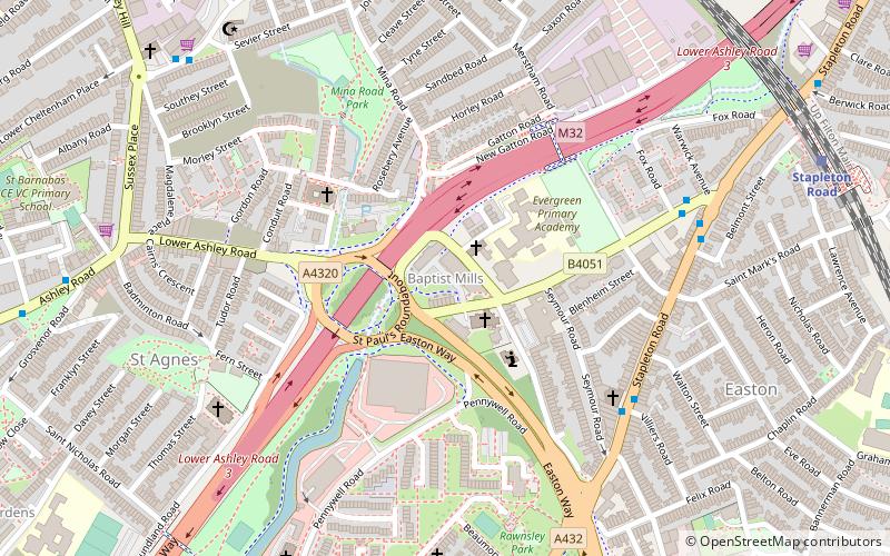
Baptist Mills, Bristol
Map
Facts and practical information
Baptist Mills an area of the city of Bristol, England. The name derives from the former mills which stood in that area. ()
Coordinates: 51°27'58"N, 2°34'25"W
Address
Lawrence HillBristol
ContactAdd
Social media
Add
Getting there by public transportation
Public transportation stops near this location
- Bus
- Train
- Ferry
 Bus
Bus
- Calculate routeStapleton Road 9 min walk
- Calculate routeLawrence Hill 17 min walk
- Calculate routeMontpelier 18 min walk
- Calculate routeRedland 29 min walk
- Calculate routeEaston Road 14 min walk
- Calculate routeCroydon Street 15 min walk
- Calculate routeLamb Street 16 min walk
- Calculate routeWest Street 17 min walk
- Calculate routeCity Centre 37 min walk
Day trips


Frequently Asked Questions (FAQ)
Which popular attractions are close to Baptist Mills?
Nearby attractions include St Peter and St Paul, Bristol (2 min walk), Stapleton Road, Bristol (5 min walk), St Werburghs, Bristol (8 min walk), St Pauls, Bristol (10 min walk).
How to get to Baptist Mills by public transport?
The nearest stations to Baptist Mills:
Train
Bus
Ferry
Train
- Stapleton Road (9 min walk)
- Lawrence Hill (17 min walk)
Bus
- Easton Road • Lines: 43 (14 min walk)
- Croydon Street • Lines: 43 (15 min walk)
Ferry
- City Centre • Lines: Hotwells-Centre (37 min walk)