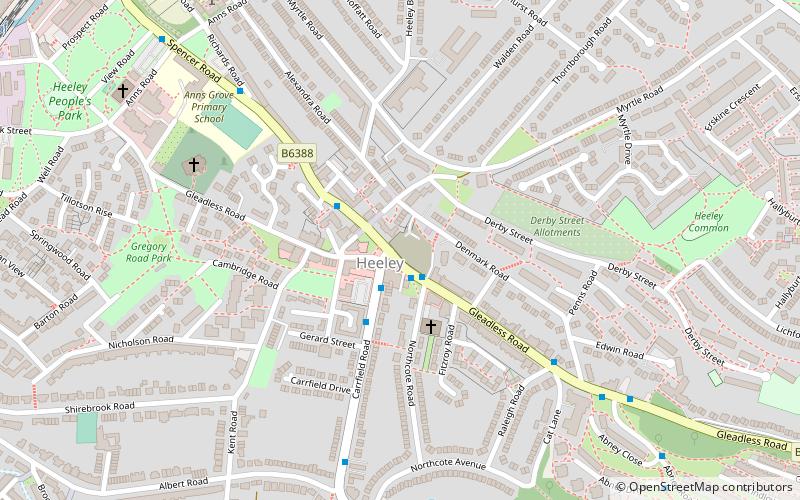
Heeley, Sheffield
Map
Facts and practical information
Heeley is a former cluster of villages. Which all now form a suburb in the south of the City of Sheffield, England. The village has existed at least since 1343, its name deriving from Heah Leah, High Lea then Hely, meaning a high, woodland clearing. Originally Heeley was divided into three: Upper Heeley was around the intersection of Myrtle Road and Heeley Green, Middle Heeley was on the Gleadless Road at Well Road, and Lower Heeley was on the London Road around Artisan View. At the 2011 Census the village formed part of the Gleadless Valley ward of the City of Sheffield. ()
Coordinates: 53°21'34"N, 1°27'48"W
Address
ArbourthorneSheffield
ContactAdd
Social media
Add
Getting there by public transportation
Public transportation stops near this location
- Bus
- Tram
 Bus
Bus
- Calculate routeGleadless Road/Carrfield Lane 1 min walk
- Calculate routeRichards Road/Gleadless Road 2 min walk
- Calculate routePark Grange 16 min walk
- Calculate routeArbourthorne Road 18 min walk
- Calculate routeGranville Road / The Sheffield College 27 min walk
Day trips


Frequently Asked Questions (FAQ)
Which popular attractions are close to Heeley?
Nearby attractions include Heeley City Farm, Sheffield (8 min walk), Madina Mosque, Sheffield (14 min walk), Meersbrook Park, Sheffield (16 min walk), Sheffield Auction Gallery, Sheffield (16 min walk).
How to get to Heeley by public transport?
The nearest stations to Heeley:
Bus
Tram
Bus
- Gleadless Road/Carrfield Lane • Lines: 11A (1 min walk)
- Richards Road/Gleadless Road • Lines: 11A (2 min walk)
Tram
- Park Grange • Lines: Blue, Purp (16 min walk)
- Arbourthorne Road • Lines: Blue, Purp (18 min walk)