Peel Green, Manchester
Map
Facts and practical information
Peel Green is a suburb at the western end of Eccles, Greater Manchester, England, in the historic county of Lancashire. ()
Coordinates: 53°28'24"N, 2°23'3"W
Address
Salford (Winton)Manchester
ContactAdd
Social media
Add
Getting there by public transportation
Public transportation stops near this location
- Bus
- Train
 Bus
Bus
- Calculate routeBrookhouse Avenue/Verdant Lane 12 min walk
- Calculate routePatricroft 35 min walk
Maps MetrolinkMaps
 Metrolink / Rail
MetrolinkMapsMetrolink / RailDay trips


Frequently Asked Questions (FAQ)
Which popular attractions are close to Peel Green?
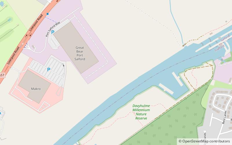
Nearby attractions include AJ Bell Stadium, Manchester (12 min walk), Port Salford, Manchester (18 min walk), Davyhulme Sewage Works, Manchester (22 min walk).
How to get to Peel Green by public transport?
The nearest stations to Peel Green:
Bus
Train
Bus
- Brookhouse Avenue/Verdant Lane • Lines: 33B (12 min walk)
Train
- Patricroft (35 min walk)