Port Salford, Manchester
Map
Facts and practical information
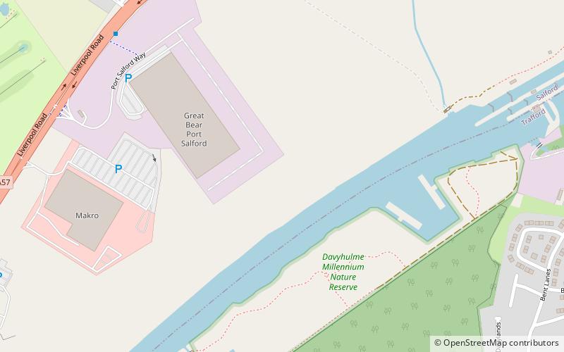
Port Salford is a freight terminal on the banks of the Manchester Ship Canal in Barton-upon-Irwell, Greater Manchester, England, 6 miles west of Manchester city centre. The port is part of the Atlantic Gateway project and its construction was led by Peel Ports, a subsidiary of the Peel Group, and was opened in 2016. ()
Coordinates: 53°27'49"N, 2°23'20"W
Address
Salford (Irlam)Manchester
ContactAdd
Social media
Add
Getting there by public transportation
Public transportation stops near this location
- Bus
 Bus
Bus
- Calculate routeWoodhouse Road/Davyhulme Road 10 min walk
- Calculate routeWoodsend Road/Calderbank Avenue 11 min walk
Maps MetrolinkMaps
 Metrolink / Rail
MetrolinkMapsMetrolink / RailDay trips


Frequently Asked Questions (FAQ)
Which popular attractions are close to Port Salford?
Nearby attractions include Davyhulme Sewage Works, Manchester (18 min walk), AJ Bell Stadium, Manchester (18 min walk), Peel Green, Manchester (18 min walk).
How to get to Port Salford by public transport?
The nearest stations to Port Salford:
Bus
Bus
- Woodhouse Road/Davyhulme Road • Lines: 15 (10 min walk)
- Woodsend Road/Calderbank Avenue • Lines: 15 (11 min walk)