Ordsall, Manchester

Gallery (2)
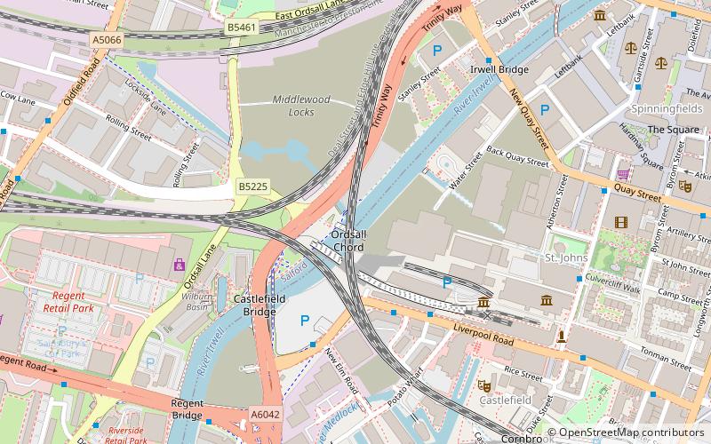
Map

Map
Gallery
Facts and practical information
Ordsall is an inner city suburb of Salford, Greater Manchester, England. The population at the 2011 census was 14,194. It lies chiefly to the south of the A57 road, close to the River Irwell, the main boundary with the city of Manchester, Salford Quays and Manchester Ship Canal, which divides it from Stretford. ()
Address
Salford (Ordsall)Manchester
ContactAdd
Social media
Add
Getting there by public transportation
Public transportation stops near this location
- Bus
- Tram
- Train
 Bus
Bus
- Calculate routePhoebe Street/West Craven Street 2 min walk
- Calculate routeRobert Hall St/Ordsall District Centre 4 min walk
- Calculate routeTrafford Road/Phoebe Street 5 min walk
- Calculate routeAnchorage 9 min walk
- Calculate routeSalford Quays 9 min walk
- Calculate routeExchange Quay 12 min walk
- Calculate routeCornbrook 14 min walk
- Calculate routeSalford Crescent 22 min walk
- Calculate routeDeansgate 29 min walk
- Calculate routeSalford Central 29 min walk
Maps MetrolinkMaps
 Metrolink / Rail
MetrolinkMapsMetrolink / RailDay trips


Frequently Asked Questions (FAQ)
Which popular attractions are close to Ordsall?
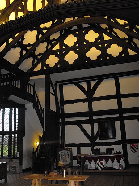
Nearby attractions include St Clement's Church, Manchester (4 min walk), Salford Lads Club, Manchester (7 min walk), Ordsall Hall, Manchester (8 min walk), Salford Quays, Manchester (16 min walk).
How to get to Ordsall by public transport?
The nearest stations to Ordsall:
Bus
Tram
Train
Bus
- Phoebe Street/West Craven Street • Lines: 79 (2 min walk)
- Robert Hall St/Ordsall District Centre • Lines: 79 (4 min walk)
Tram
- Anchorage • Lines: Asht, Eccl, Mcuk (9 min walk)
- Salford Quays • Lines: Asht, Eccl, Mcuk (9 min walk)
Train
- Salford Crescent (22 min walk)
- Deansgate (29 min walk)