Vauxhall Gardens, London
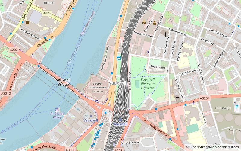
Map
Facts and practical information
Vauxhall Gardens is a public park in Kennington in the London Borough of Lambeth, England, on the south bank of the River Thames. ()
Address
Lambeth (Prince's)London
ContactAdd
Social media
Add
Getting there by public transportation
Public transportation stops near this location
- Metro
- Bus
- Train
- Ferry
 Metro
Metro
- Calculate routeVauxhall 4 min walk
- Calculate routeLondon Victoria 27 min walk
- Calculate routeElephant & Castle 29 min walk
- Calculate routeLondon Waterloo 29 min walk
- Calculate routeVauxhall 4 min walk
- Calculate routePimlico 14 min walk
- Calculate routeNine Elms 16 min walk
- Calculate routeOval 16 min walk
- Calculate routeVauxhall Bus Station 5 min walk
- Calculate routeDurham Street / Harleyford Road 7 min walk
- Calculate routeHarleyford Road / Durham Street 7 min walk
- Calculate routeSt George Wharf Pier 10 min walk
- Calculate routeSt. George Wharf 6 min walk
- Calculate routeMillbank Millennium Pier 8 min walk
- Calculate routeWestminster Pier 25 min walk
- Calculate routeBattersea Power Station Pier 27 min walk
Maps Tube
Tube
TubeDay trips


Frequently Asked Questions (FAQ)
Which popular attractions are close to Vauxhall Gardens?
Nearby attractions include Albert Embankment, London (4 min walk), SIS Building, London (4 min walk), Riverside, London (4 min walk), Vauxhall, London (6 min walk).
How to get to Vauxhall Gardens by public transport?
The nearest stations to Vauxhall Gardens:
Train
Metro
Bus
Ferry
Train
- Vauxhall (4 min walk)
- London Victoria (27 min walk)
Metro
- Vauxhall • Lines: Victoria (4 min walk)
- Pimlico • Lines: Victoria (14 min walk)
Bus
- Vauxhall Bus Station (5 min walk)
- Durham Street / Harleyford Road • Lines: 185, 36, 436, N136 (7 min walk)
Ferry
- St. George Wharf • Lines: Rb2 (6 min walk)
- Millbank Millennium Pier • Lines: Rb2 (8 min walk)