Lady Margaret Hall, Oxford
Map
Facts and practical information
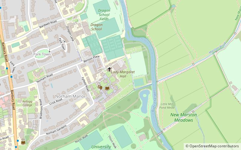
Lady Margaret Hall is one of the constituent colleges of the University of Oxford in England, located on the banks of the River Cherwell at Norham Gardens in north Oxford and adjacent to the University Parks. The college is more formally known under its current royal charter as "The Principal and Fellows of the College of the Lady Margaret in the University of Oxford". ()
Getting there by public transportation
Public transportation stops near this location
- Bus
- Train
 Bus
Bus
- Calculate routePlantation Road 13 min walk
- Calculate routeSt Margarets Road 15 min walk
- Calculate routeCherwell School 18 min walk
- Calculate routeOxford 29 min walk
Day trips


Frequently Asked Questions (FAQ)
Which popular attractions are close to Lady Margaret Hall?
Nearby attractions include Fyfield Road, Oxford (3 min walk), Norham Manor, Oxford (5 min walk), Crick Road, Oxford (5 min walk), Norham Gardens, Oxford (6 min walk).
How to get to Lady Margaret Hall by public transport?
The nearest stations to Lady Margaret Hall:
Bus
Train
Bus
- Plantation Road • Lines: 35, 853 (13 min walk)
- St Margarets Road • Lines: 35, 853 (15 min walk)
Train
- Oxford (29 min walk)