Tower of Refuge, Douglas

Gallery (1)
Map
Map
Facts and practical information
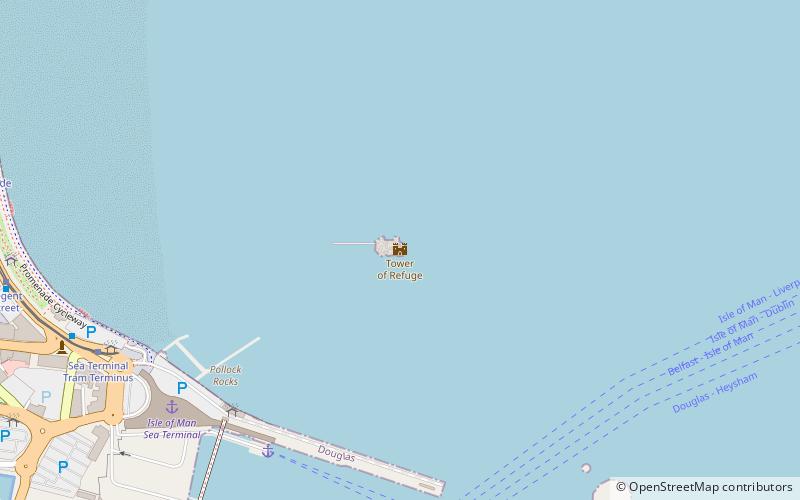
The Tower of Refuge is a stone-built castellated structure which was erected on St Mary's Isle in Douglas Bay, Isle of Man, in order to afford shelter to mariners wrecked on the rock. The tower was constructed through the endeavours of Sir William Hillary, who had been instrumental in several rescues of sailors stranded on the rock, and which culminated in the heroic rescue of the crew of the Saint George Steam Packet Company steamer RMS St George, when it foundered on the rock in the early hours of November 20, 1830. Sir William personally contributed a high proportion of the costs and secured a substantial number of public contributions for funding the structure. ()
Coordinates: 54°9'1"N, 4°28'7"W
Address
Douglas
ContactAdd
Social media
Add
Getting there by public transportation
Public transportation stops near this location
- Bus
- Tram
- Light rail
- Train
 Bus
Bus
- Calculate routeSea Terminal Tram Terminus 8 min walk
- Calculate routeRegent Street 9 min walk
- Calculate routeLoch Promenade / Regent Street 10 min walk
- Calculate routeLoch Promenade 10 min walk
- Calculate routeVictoria Street 10 min walk
- Calculate routeQueen's Prom, Regency Hotel 28 min walk
- Calculate routeQueens Promenade / Regency Hotel 28 min walk
- Calculate routeDouglas Railway Station 18 min walk
- Calculate routeDerby Castle Terminus 31 min walk
- Calculate routeDerby Castle Depôt 32 min walk
- Calculate routePort Jack 34 min walk
- Calculate routeDerby Castle M.E.R. Station 31 min walk
- Calculate routePort Jack 34 min walk
Day trips


Frequently Asked Questions (FAQ)
Which popular attractions are close to Tower of Refuge?
Nearby attractions include St Mary's Isle, Douglas (1 min walk), Douglas Head, Douglas (13 min walk), Douglas Head Lighthouse, Douglas (13 min walk), Douglas War Memorial, Douglas (14 min walk).
How to get to Tower of Refuge by public transport?
The nearest stations to Tower of Refuge:
Tram
Bus
Train
Light rail
Tram
- Sea Terminal Tram Terminus • Lines: Douglas Horse Tramway (8 min walk)
- Regent Street • Lines: Douglas Horse Tramway (9 min walk)
Bus
- Loch Promenade • Lines: 1 (10 min walk)
- Victoria Street • Lines: 1 (10 min walk)
Train
- Douglas Railway Station (18 min walk)
- Derby Castle Terminus (31 min walk)
Light rail
- Derby Castle M.E.R. Station • Lines: Manx Electric Railway (31 min walk)
- Port Jack • Lines: Manx Electric Railway (34 min walk)