Buck O'Neil Bridge, Kansas City

Gallery (1)
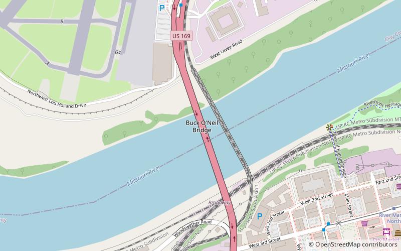
Map
Map
Facts and practical information
The Buck O'Neil Bridge is a triple arch bridge that spans the Missouri River in Kansas City, Missouri, in the United States. It first opened for traffic September 9, 1956 as the Broadway Bridge. It was built at a cost of $12 million. It was a toll bridge until 1991. ()
Coordinates: 39°6'47"N, 94°35'24"W
Address
Broadway Street becomes Hwy 169 NorthNorthlandKansas City 64105
ContactAdd
Social media
Add
Getting there by public transportation
Public transportation stops near this location
- Bus
- Tram
 Bus
Bus
- Calculate route3rd at Delaware 10 min walk
- Calculate routeWyandotte at Independence 12 min walk
- Calculate routeGrand at 3rd 13 min walk
- Calculate route3rd at Grand 14 min walk
- Calculate routeRiver Market West 11 min walk
- Calculate routeCity Market 14 min walk
- Calculate routeNorth Loop 17 min walk
Day trips


Frequently Asked Questions (FAQ)
Which popular attractions are close to Buck O'Neil Bridge?
Nearby attractions include Hannibal Bridge, Kansas City (2 min walk), Second Hannibal Bridge, Kansas City (2 min walk), River Market, Kansas City (11 min walk), Arabia Steamboat Museum, Kansas City (14 min walk).
How to get to Buck O'Neil Bridge by public transport?
The nearest stations to Buck O'Neil Bridge:
Bus
Tram
Bus
- 3rd at Delaware • Lines: 55 (10 min walk)
- Wyandotte at Independence • Lines: 55 (12 min walk)
Tram
- River Market West • Lines: 601 (11 min walk)
- City Market • Lines: 601 (14 min walk)