Lava Butte, Bend

Gallery (4)
Map

Map
Gallery
Facts and practical information
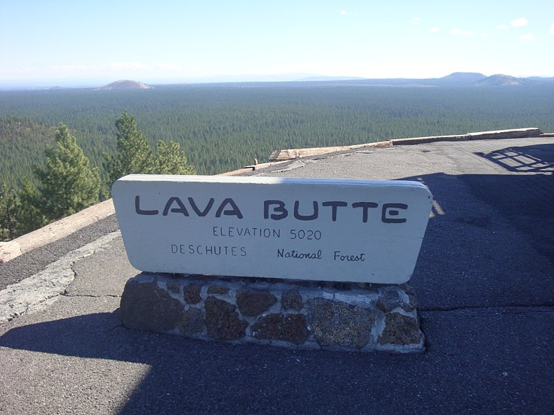
Lava Butte is a cinder cone in central Oregon, United States, just west of U.S. Route 97 between the towns of Bend, Oregon, and Sunriver, Oregon in Deschutes County. It is part of a system of small cinder cones on the northwest flank of Newberry Volcano, a massive shield volcano which rises to the southeast. The cinder cone is capped by a crater which extends about 60 feet deep beneath its south rim, and 160 feet deep from the 5,020-foot summit on its north side. Lava Butte is part of the Newberry National Volcanic Monument. ()
Elevation: 5023 ftProminence: 509 ftCoordinates: 43°55'3"N, 121°21'22"W
Day trips