Warwick Village, Louisville
Map
Facts and practical information
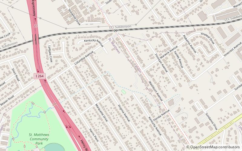
Warwick Village is a neighborhood located in Louisville, Kentucky. Warwick Village is just outside the Watterson Expressway and part of the City of St. Matthews, Its boundaries are roughly New La Grange Rd, Washburn Ave, and Columbia Ave. Many of Warwick Village's streets are surrounded by Warwick Park also known as Warwick-Villa Park Playground. ()
Coordinates: 38°15'30"N, 85°37'2"W
Address
East LouisvilleLouisville
ContactAdd
Social media
Add
Getting there by public transportation
Public transportation stops near this location
- Bus
 Bus
Bus
- Calculate routeLyndon / Warwick 16 min walk
- Calculate routeHerr / Lyndon 16 min walk
- Calculate routeLaGrange / Lyndon 17 min walk
- Calculate routeShelbyville / Norwood 17 min walk
Day trips


Frequently Asked Questions (FAQ)
How to get to Warwick Village by public transport?
The nearest stations to Warwick Village:
Bus
Bus
- Lyndon / Warwick • Lines: 15East LaGrange, 15West LaGrange (16 min walk)
- Herr / Lyndon • Lines: 15East LaGrange, 15West LaGrange (16 min walk)