Trek Zone

Eagle Rock, Santa Monica Mountains National Recreation Area

#7 among attractions in Santa Monica Mountains National Recreation Area

Nature, Natural attraction, Mountain, View point
Eagle Rock location map
Map

Facts and practical information
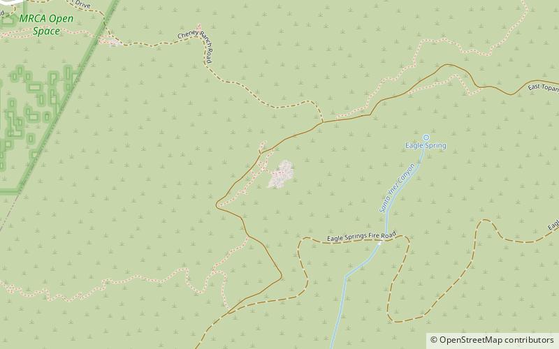
Elevation: 1957 ftCoordinates: 34°6'27"N, 118°34'16"W
Address

Santa Monica Mountains National Recreation Area United States

ContactAdd
Social media
Add
Day trips

Eagle Rock – popular in the area (distance from the attraction)

Nearby attractions include: Getty Villa, The Commons at Calabasas, Self-Realization Fellowship Lake Shrine, Theatricum Botanicum.

  • getty villa santa monica mountains national recreation area4.3 miS
  • the commons at calabasas5.2 miNW
  • self realization fellowship lake shrine los angeles4.6 miS
  • theatricum botanicum topanga location map
    1.3 miW
  • calabasas peak santa monica mountains national recreation area location map
    4.7 miW
  • bel air church los angeles5.2 miE
  • will rogers state historic park santa monica mountains national recreation area4.8 miSE
  • palisades village santa monica location map
    4.9 miSE
  • pacific palisades business block santa monica4.9 miSE
  • san vicente mountain santa monica mountains national recreation area3.6 miNE
  • mulholland drive los angeles4.9 miE

Where to next? Visit california California region page or discover the top tourist attractions in United States.