Stevenson Field, Providence
Map
Facts and practical information
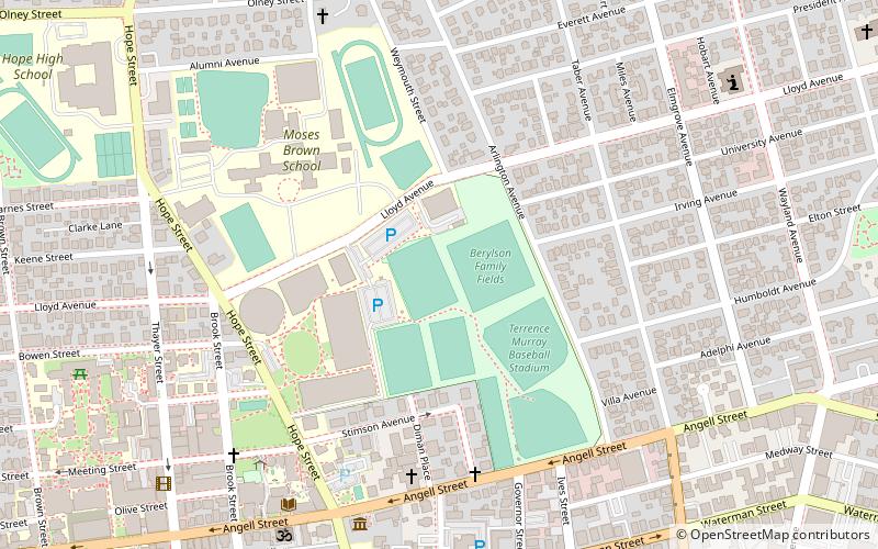
Stevenson-Pincince Field is a stadium in Providence, Rhode Island on the campus of Brown University. It is home to the Brown Bears soccer and lacrosse programs. ()
Opened: 1979 (47 years ago)Capacity: 3500Coordinates: 41°49'55"N, 71°23'44"W
Address
College HillProvidence
ContactAdd
Social media
Add
Getting there by public transportation
Public transportation stops near this location
- Bus
- Train
 Bus
Bus
- Calculate routeProvidence 24 min walk
- Calculate routeMemorial and Exchange 25 min walk
- Calculate routeKennedy Plaza Stop Y 25 min walk
- Calculate routeExchange Terrace Stop X 25 min walk
- Calculate routeKennedy Plaza Intermodal Transportation Center 26 min walk
Day trips


Frequently Asked Questions (FAQ)
Which popular attractions are close to Stevenson Field?
Nearby attractions include Stimson Avenue Historic District, Providence (5 min walk), Central Congregational Church, Providence (6 min walk), Governor Henry Lippitt House, Providence (8 min walk), Olney Street–Alumni Avenue Historic District, Providence (8 min walk).
How to get to Stevenson Field by public transport?
The nearest stations to Stevenson Field:
Train
Bus
Train
- Providence (24 min walk)
Bus
- Memorial and Exchange • Lines: 12x, 14, 21, 30, 65x, 95x (25 min walk)
- Kennedy Plaza Stop Y • Lines: 49, 60 (25 min walk)