Gnadinger Park, Louisville
Map
Facts and practical information
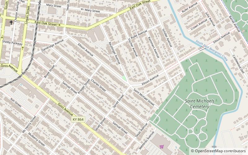
Gnadinger Park is the smallest public park in Louisville, Kentucky. It is located in the Germantown neighborhood at the intersection of Reutlinger and Ellison Avenues. The property was donated to the City of Louisville and dedicated as a park in 1977. It is registered as being just 0.03 acre in size. The property once belonged to Frank and Mary Gnadinger who had built a house on the property at 1027 Ellison Avenue in 1923. ()
Elevation: 469 ft a.s.l.Coordinates: 38°13'48"N, 85°43'60"W
Getting there by public transportation
Public transportation stops near this location
- Bus
 Bus
Bus
- Calculate routeEastern Parkway / 1138 12 min walk
- Calculate routeEastern Parkway / Poplar Level 12 min walk
Day trips


Frequently Asked Questions (FAQ)
Which popular attractions are close to Gnadinger Park?
Nearby attractions include St. Therese of Lisieux Church, Louisville (10 min walk), St. Vincent de Paul Catholic Church, Louisville (12 min walk), St. Elizabeth's Catholic Church, Louisville (16 min walk), German Evangelical Church of Christ Complex, Louisville (18 min walk).
How to get to Gnadinger Park by public transport?
The nearest stations to Gnadinger Park:
Bus
Bus
- Eastern Parkway / 1138 • Lines: 29East Bardstown Rd, 29East Oxmoor (12 min walk)
- Eastern Parkway / Poplar Level • Lines: 29East Bardstown Rd, 29East Oxmoor, 29West Bardstown Rd, 29West Oxmoor (12 min walk)