Trek Zone

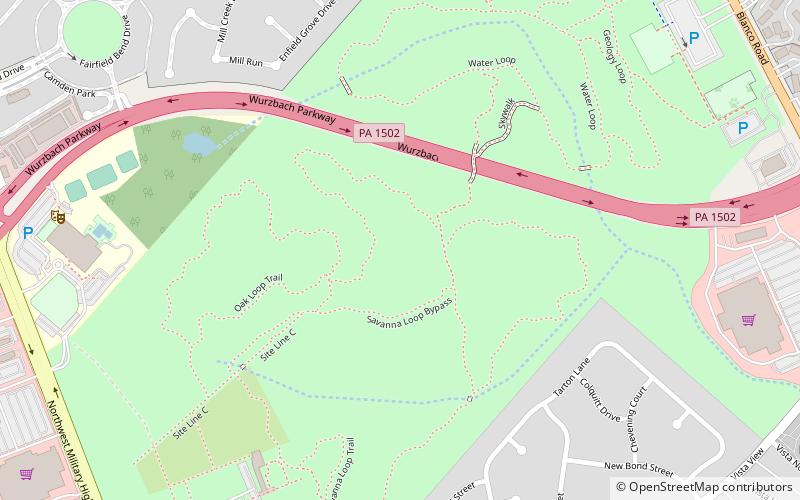
Phil Hardberger Park, San Antonio

#119 among attractions in San Antonio

Park, Relax in park
Phil Hardberger Park location map
Map

Facts and practical information

Created: 2010Elevation: 892 ft a.s.l.Coordinates: 29°33'26"N, 98°31'34"W
Address

North San AntonioSan Antonio United States

ContactAdd
Social media
Add
Day trips

Phil Hardberger Park – popular in the area (distance from the attraction)

Nearby attractions include: North Star Mall, Alamo Quarry Market, Wonderland of the Americas, Texas Transportation Museum.

  • north star mall san antonio3.2 miSE
  • alamo quarry market san antonio5 miSE
  • wonderland of the americas san antonio location map
    4.7 miS
  • texas transportation museum san antonio5.4 miE
  • oak hills country club san antonio location map
    4.6 miSW
  • alamo heights san antonio location map
    6.2 miSE
  • balcones heights san antonio location map
    4.8 miS
  • castle hills san antonio location map
    2.4 miS
  • fence at alamo cement company san antonio5 miSE
  • holocaust memorial museum of san antonio0.4 miW
  • grace point church san antonio location map
    4.2 miSW

Frequently Asked Questions (FAQ)

Which popular attractions are close to Phil Hardberger Park?

Nearby attractions include Robert L.B. Tobin Land Bridge, San Antonio (4 min walk), Holocaust Memorial Museum of San Antonio, San Antonio (11 min walk).

Where to next? Visit texas Texas region page or discover the top tourist attractions in United States.