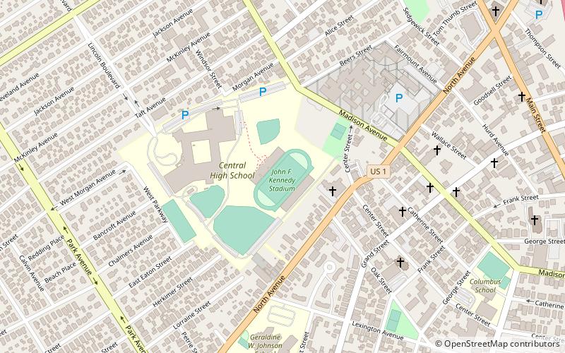
John F. Kennedy Stadium, Bridgeport
Map
Facts and practical information
John F. Kennedy Stadium is a 12,000-seat lighted stadium located at Central High School in Bridgeport, Connecticut. The stadium is designed for use for football, soccer, lacrosse games and track and field meets. ()
Opened: 1964 (62 years ago)Capacity: 12 thous.Coordinates: 41°11'18"N, 73°12'13"W
Address
West Side - West End (Brooklawn - St. Vincent)Bridgeport
ContactAdd
Social media
Add
Getting there by public transportation
Public transportation stops near this location
- Bus
- Train
 Bus
Bus
- Calculate routeA5 25 min walk
- Calculate routeA4 25 min walk
- Calculate routeA3 25 min walk
- Calculate routeB6 25 min walk
- Calculate routeBridgeport 29 min walk
Day trips


Frequently Asked Questions (FAQ)
Which popular attractions are close to John F. Kennedy Stadium?
Nearby attractions include St. Patrick's Church, Bridgeport (12 min walk), Ephraim, Bridgeport (15 min walk), Cardinal Shehan Center, Bridgeport (18 min walk), St Margaret Shrine, Bridgeport (18 min walk).
How to get to John F. Kennedy Stadium by public transport?
The nearest stations to John F. Kennedy Stadium:
Bus
Train
Bus
- A5 • Lines: 13 (25 min walk)
- A4 • Lines: 15, 19X, 23 (25 min walk)
Train
- Bridgeport (29 min walk)